


Summary
Napier South | |
|---|---|
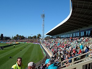 McLean Park | |
 | |
| Coordinates: 39°30′00″S 176°54′47″E / 39.500°S 176.913°E | |
| Country | New Zealand |
| City | Napier |
| Local authority | Napier City Council |
| Electoral ward | Nelson Park |
| Area | |
| • Land | 212 ha (524 acres) |
| Population (June 2023)[2] | |
| • Total | 5,010 |
| Hospital Hill | Central Napier | |
| Marewa |
|
(Hawke Bay) |
| Meeanee | Te Awa |
Napier South is a suburb of the city of Napier, in the Hawke's Bay region of New Zealand's eastern North Island.[3]
Demographics edit
Napier South covers 2.12 km2 (0.82 sq mi)[1] and had an estimated population of 5,010 as of June 2023,[2] with a population density of 2,363 people per km2.
| Year | Pop. | ±% p.a. |
|---|---|---|
| 2006 | 4,521 | — |
| 2013 | 4,545 | +0.08% |
| 2018 | 4,731 | +0.81% |
| Source: [4] | ||
Napier South had a population of 4,731 at the 2018 New Zealand census, an increase of 186 people (4.1%) since the 2013 census, and an increase of 210 people (4.6%) since the 2006 census. There were 1,833 households, comprising 2,235 males and 2,496 females, giving a sex ratio of 0.9 males per female, with 969 people (20.5%) aged under 15 years, 870 (18.4%) aged 15 to 29, 2,163 (45.7%) aged 30 to 64, and 729 (15.4%) aged 65 or older.
Ethnicities were 83.8% European/Pākehā, 21.3% Māori, 2.9% Pacific peoples, 4.8% Asian, and 2.0% other ethnicities. People may identify with more than one ethnicity.
The percentage of people born overseas was 15.8, compared with 27.1% nationally.
Although some people chose not to answer the census's question about religious affiliation, 56.0% had no religion, 30.1% were Christian, 2.0% had Māori religious beliefs, 0.7% were Hindu, 0.7% were Muslim, 0.6% were Buddhist and 2.9% had other religions.
Of those at least 15 years old, 699 (18.6%) people had a bachelor's or higher degree, and 708 (18.8%) people had no formal qualifications. 468 people (12.4%) earned over $70,000 compared to 17.2% nationally. The employment status of those at least 15 was that 1,839 (48.9%) people were employed full-time, 597 (15.9%) were part-time, and 162 (4.3%) were unemployed.[4]
| Name | Area (km2) |
Population | Density (per km2) |
Households | Median age | Median income |
|---|---|---|---|---|---|---|
| Nelson Park | 0.78 | 2,181 | 2,796 | 837 | 40.4 years | $27,600[5] |
| McLean Park | 1.34 | 2,550 | 1,903 | 996 | 38.3 years | $28,500[6] |
| New Zealand | 37.4 years | $31,800 |
Education edit
Nelson Park School is a co-educational Year 0–6 state primary school situated on Kennedy Road/Jull Street with a roll of 325.[7] It opened as Napier West School in 1914.[8]
Napier Intermediate is a co-educational state intermediate school situated on Jull Street with a roll of 342.[9] It was founded in 1933.[10]
Both schools are co-educational. Rolls are as of February 2024.[11]
References edit
- ^ a b "ArcGIS Web Application". statsnz.maps.arcgis.com. Retrieved 20 February 2023.
- ^ a b "Population estimate tables - NZ.Stat". Statistics New Zealand. Retrieved 25 October 2023.
- ^ Hariss, Gavin. "Napier South". NZ Topo Map.
- ^ a b "Statistical area 1 dataset for 2018 Census". Statistics New Zealand. March 2020. Nelson Park (214500) and McLean Park (215200).
- ^ 2018 Census place summary: Nelson Park
- ^ 2018 Census place summary: McLean Park
- ^ Education Counts: Nelson Park School
- ^ Campbell, James McDonnell (1964). Nelson Park School (Napier West School) – Souvenir Booklet of the Golden Jubilee, April 17th, 18th and 19th, 1964. Jubilee Committee.
- ^ Education Counts: Napier Intermediate
- ^ Langford, William Edward (1983). Napier Intermediate School 50th Jubilee, 1933-1983. Napier Intermediate School Jubilee Committee.
- ^ "New Zealand Schools Directory". New Zealand Ministry of Education. Retrieved 14 March 2024.