
KNOWPIA
WELCOME TO KNOWPIA

Umurata 
Summary
Umurata[2] is a mountain in the Andes, about 5,717 m (18,757 ft) high, situated in the Cordillera Occidental on the border of Bolivia and Chile. It is located in the Arica and Parinacota Region of Chile and in the Oruro Department of Bolivia, in the Sajama Province, Turku Municipality, Chachakumani Canton. Umurata lies south of the Uqi Uqini volcano, north of the Acotango and north-east of the Wallatiri volcano.[3] Argon-argon dating has yielded ages of 970,000±120,000 for Umurata rocks.[4] Umurata is situated south of National Route 4 near the Chungara-Tambo Quemado pass.
| Umurata | |
|---|---|
 Chungara-Tambo Quemado pass with the mountains Umurata, Acotango and Capurata in the background (from l. to r.) | |
| Highest point | |
| Elevation | 5,717 m (18,757 ft)[1] |
| Coordinates | 18°21′20″S 69°2′59″W / 18.35556°S 69.04972°W |
| Geography | |
 Umurata Location in Bolivia, on the border with Chile | |
| Location | Bolivia-Chile |
| Parent range | Andes, Cordillera Occidental |
| Climbing | |
| First ascent | 1-1984 |
See also edit
References edit
- ^ Jill Neate, Taken from Mountaineering in the Andes
- ^ commons.wikimedia.org See map.
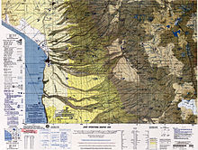
- ^ Turku Municipality: population data and map
- ^ Sepúlveda, José Pablo; Aguilera, Felipe; Inostroza, Manuel; Reyes, María Paz (April 2021). "Geological evolution of the Guallatiri volcano, Arica y Parinacota Region, northern Chile". Journal of South American Earth Sciences. 107: 4. doi:10.1016/j.jsames.2020.103117. ISSN 0895-9811. S2CID 233072322.