
KNOWPIA
WELCOME TO KNOWPIA

Sanatorne 
Summary
Sanatorne (Ukrainian: Санаторне; Russian: Санаторное; Crimean Tatar: Melas, from Greek Μέλας) is an urban-type settlement in the Yalta Municipality of the Autonomous Republic of Crimea, a territory recognized by a majority of countries as part of Ukraine and annexed by Russia as the Republic of Crimea.[3]
Sanatorne
Санаторне | |
|---|---|
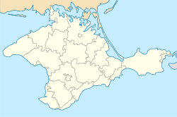 Sanatorne Location of Sanatorne in Crimea | |
| Coordinates: 44°23′54″N 33°48′47″E / 44.39833°N 33.81306°E | |
| Country | Territory of Ukraine, occupied by Russia[1] |
| Republic | Crimea |
| Municipality | Yalta Municipality |
| Town status | 1971 |
| Elevation | 79 m (259 ft) |
| Population (2014) | |
| • Total | 232 |
| Time zone | UTC+4 (MSK) |
| Postal code | 98692 |
| Area code | +380 654 |
| Climate | Cfb |
| Website | http://rada.gov.ua/ |

Sanatorne is located on Crimea's southern shore at an elevation of 79 metres (259 ft).[2] The settlement is located 3 km (1.9 mi) east from Foros, which it is administratively subordinate to.[3] Its population was 531 in the 2001 Ukrainian census.[3] Current population: 232 (2014 Census).[4]
References edit
- ^ This place is located on the Crimean peninsula, which is internationally recognized as part of Ukraine, but since 2014 under Russian occupation. According to the administrative-territorial division of Ukraine, there are the Ukrainian divisions (the Autonomous Republic of Crimea and the city with special status of Sevastopol) located on the peninsula. Russia claims these as federal subjects of the Russian Federation (the Republic of Crimea and the federal city of Sevastopol).
- ^ a b "Sanatorne (Crimea region)". weather.in.ua. Retrieved 30 July 2014.
- ^ a b c "Sanatorne, Autonomous Republic of Crimea, City of Yalta". Regions of Ukraine and their Structure (in Ukrainian). Verkhovna Rada of Ukraine. Archived from the original on 8 August 2014. Retrieved 30 July 2014.
- ^ Russian Federal State Statistics Service (2014). "Таблица 1.3. Численность населения Крымского федерального округа, городских округов, муниципальных районов, городских и сельских поселений" [Table 1.3. Population of Crimean Federal District, Its Urban Okrugs, Municipal Districts, Urban and Rural Settlements]. Федеральное статистическое наблюдение «Перепись населения в Крымском федеральном округе». ("Population Census in Crimean Federal District" Federal Statistical Examination) (in Russian). Federal State Statistics Service. Retrieved January 4, 2016.