


Summary
Fort Apache (Western Apache: Tłʼog Hagai) is an unincorporated community in Navajo County, Arizona, United States. Today's settlement of Fort Apache incorporates elements of the original U.S. Cavalry post Fort Apache, and lies within the Fort Apache Indian Reservation, home of the White Mountain Apache Tribe, 2 miles (3.2 km) east of Canyon Day. Fort Apache has a post office with ZIP code 85926.[4]
Fort Apache, Arizona | |
|---|---|
 Commanding Officer's Quarters at Fort Apache Historic Site | |
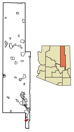 Location of Fort Apache in Navajo County, Arizona. | |
 Fort Apache, Arizona  Fort Apache, Arizona | |
| Coordinates: 33°47′26″N 109°59′12″W / 33.79056°N 109.98667°W | |
| Country | United States |
| State | Arizona |
| County | Navajo |
| Area | |
| • Total | 1.15 sq mi (2.98 km2) |
| • Land | 1.14 sq mi (2.95 km2) |
| • Water | 0.01 sq mi (0.04 km2) |
| Elevation | 5,056 ft (1,541 m) |
| Population (2010) | |
| • Total | 143 |
| • Estimate (2016)[3] | N/A |
| Time zone | UTC-7 (Mountain (MST)) |
| ZIP code | 85926 |
| Area code | 928 |
| GNIS feature ID | 4740[2] |
Demographics edit
| Census | Pop. | Note | %± |
|---|---|---|---|
| 2010 | 143 | — | |
| U.S. Decennial Census[5] | |||
As of the census[6] of 2010, there were 143 people, 46 households, and 36 families residing in Fort Apache.
Climate edit
This region has warm (but not hot) and dry summers, with no average monthly temperatures above 71.6 °F (22.0 °C). According to the Köppen Climate Classification system, Fort Apache has a warm-summer Mediterranean climate, abbreviated "Csb" on climate maps.[7]
Transportation edit
The White Mountain Apache Tribe operates the Fort Apache Connection Transit, which provides local bus service.[8]
See also edit
References edit
- ^ "2016 U.S. Gazetteer Files". United States Census Bureau. Retrieved July 18, 2017.
- ^ a b U.S. Geological Survey Geographic Names Information System: Fort Apache, Arizona
- ^ "Population and Housing Unit Estimates". Retrieved June 9, 2017.
- ^ ZIP Code Lookup
- ^ "Census of Population and Housing". Census.gov. Retrieved June 4, 2016.
- ^ "American FactFinder". United States Census Bureau. Archived from the original on February 13, 2020. Retrieved October 10, 2018.
- ^ Climate Summary for Fort Apache, Arizona
- ^ "Tribal Transportation". WMAT DOT. Retrieved February 3, 2020.
External links edit
![]() Media related to Fort Apache, Arizona at Wikimedia Commons
Media related to Fort Apache, Arizona at Wikimedia Commons