


Summary
Deans is an unincorporated community and census-designated place (CDP)[5] located within South Brunswick Township in Middlesex County, in the U.S. state of New Jersey.[6]
Deans, New Jersey | |
|---|---|
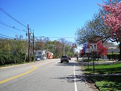 Center of Deans at Georges Road and Deans Lane | |
| Coordinates: 40°24′15″N 74°30′58″W / 40.40417°N 74.51611°W | |
| Country | |
| State | |
| County | Middlesex |
| Township | South Brunswick |
| Area | |
| • Total | 1.13 sq mi (2.93 km2) |
| • Land | 1.12 sq mi (2.90 km2) |
| • Water | 0.01 sq mi (0.03 km2) |
| Elevation | 85 ft (26 m) |
| Population | |
| • Total | 1,615 |
| • Density | 1,440.68/sq mi (556.36/km2) |
| ZIP Code | 08852 |
| FIPS code | 34-16720[4] |
| GNIS feature ID | 875833[2] |


Deans originated from its location on both Crosswicknung Trail (Georges Road) and Lawrence Brook. Dams were built on the brook, creating Deans Pond. The community is centered about the intersection of Deans Lane (County Route 610) and Georges Road (CR 697). CR 610 continues east from the community on Deans Rhode Hall Road; other transportation facilities that pass near Deans include U.S. Route 130 just east of the community and the Northeast Corridor railroad to the west (a station serving the community once existed[7]). Residential homes dot the area around Deans but some businesses line nearby arterial roads and large warehouses are situated along Industrial Way at US 130.[8]
Demographics edit
As of the 2020 United States census, the area had a population of 1,615.[3]
| Census | Pop. | Note | %± |
|---|---|---|---|
| 2020 | 1,615 | — | |
| U.S. Decennial Census[9] 2020[3] | |||
References edit
- ^ "ArcGIS REST Services Directory". United States Census Bureau. Retrieved October 11, 2022.
- ^ a b "Deans". Geographic Names Information System. United States Geological Survey, United States Department of the Interior.
- ^ a b c Census Data Explorer: Deans CDP, New Jersey, United States Census Bureau. Accessed June 15, 2023.
- ^ Geographic Codes Lookup for New Jersey, Missouri Census Data Center. Accessed June 9, 2023.
- ^ State of New Jersey Census Designated Places - BVP20 - Data as of January 1, 2020, United States Census Bureau. Accessed December 1, 2022.
- ^ Locality Search, State of New Jersey. Accessed February 7, 2015.
- ^ Pennsylvania Railroad and Its Connections (Map). December 1, 1911. Retrieved January 17, 2015.
- ^ Google (May 17, 2015). "Aerial view of Deans" (Map). Google Maps. Google. Retrieved May 17, 2015.
- ^ Census of Population and Housing, United States Census Bureau. Accessed June 1, 2023.