


Summary
Waingapu is the largest town in the eastern half of the island of Sumba, East Nusa Tenggara, Indonesia. It is the capital town of the Regency of Sumba Timur. The town comprises two administrative Districts of the regency, sub-divided into 11 urban (kelurahan) and 4 rural (desa) villages. The western part is the administrative Waingapu Town District, while the eastern part is the separate Kambera District. Their areas and their populations at the 2010 and 2020 Censuses are tabled below, together with the official estimates as at mid 2022.[1]
Waingapu | |
|---|---|
 View of Waingapu, Sumba | |
 Waingapu Location in Indonesia 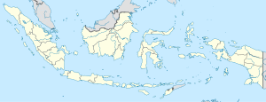 Waingapu Waingapu (Indonesia) | |
| Coordinates: 09°39′S 120°16′E / 9.650°S 120.267°E | |
| Country | Indonesia |
| Region | Lesser Sunda Islands |
| Province | East Nusa Tenggara |
| Regency | East Sumba |
| Area | |
| • Total | 125.8 km2 (48.6 sq mi) |
| Population (mid 2022 estimate) | |
| • Total | 70,060 |
| [1] | |
| Time zone | UTC+8 (WITA / UTC) |
| Name of District (kecamatan) |
Area in km2 |
Pop'n Census 2010 |
Pop'n Census 2020 |
Pop'n Estimate mid 2022 |
Post code |
|---|---|---|---|---|---|
| Kota Waingapu (a) | 73.8 | 35,142 | 35,856 | 36,062 | 87111-87116 |
| Kambera (b) | 52.0 | 31,137 | 33,466 | 33,998 | 87113-87116 |
| Totals | 125.8 | 66,279 | 69,333 | 70,060 |
Note: (a) comprises 4 kelurahan and 3 desa. (b) comprises 7 keluraham and 1 desa.
Transportation edit
Sumba Timur's Waingapu Airport 'Umbu Mehang Kunda' (IATA: WGP - ICAO: WRRW) is located in Waingapu, and the town is served by ferries from nearby islands.
Climate edit
Waingapu has a hot semi-arid climate (Köppen BSh) with relatively cooler dry season and hotter wet season. It has high humidity year round. It is the driest place in Indonesia with only 810 millimetres (32 in) of rain yearly.
| Climate data for Waingapu | |||||||||||||
|---|---|---|---|---|---|---|---|---|---|---|---|---|---|
| Month | Jan | Feb | Mar | Apr | May | Jun | Jul | Aug | Sep | Oct | Nov | Dec | Year |
| Mean daily maximum °C (°F) | 32.0 (89.6) |
32 (90) |
32 (90) |
32 (90) |
31 (88) |
31 (88) |
31 (88) |
31 (88) |
32 (90) |
33 (91) |
33 (91) |
33 (91) |
31.9 (89.6) |
| Daily mean °C (°F) | 28 (82) |
28 (82) |
28 (82) |
27.5 (81.5) |
27 (81) |
26 (79) |
25.5 (77.9) |
25.5 (77.9) |
26.5 (79.7) |
28 (82) |
28.5 (83.3) |
28.5 (83.3) |
27.3 (81.0) |
| Mean daily minimum °C (°F) | 24.0 (75.2) |
24 (75) |
24 (75) |
23 (73) |
23 (73) |
21 (70) |
20 (68) |
20 (68) |
21 (70) |
23 (73) |
24 (75) |
24 (75) |
22.6 (72.5) |
| Average rainfall mm (inches) | 170 (6.7) |
160 (6.3) |
145 (5.7) |
70 (2.8) |
35 (1.4) |
25 (1.0) |
10 (0.4) |
5 (0.2) |
5 (0.2) |
10 (0.4) |
40 (1.6) |
135 (5.3) |
810 (32) |
| Source: Climates To Travel[2] | |||||||||||||
References edit
External links edit
- Waingapu.Com
- Official Sumba Timur Website on Waingapu
- Blie.Info Top Places In East Sumba