


Summary
Sultangazi is municipality and district of Istanbul Province, Turkey.[2] Its area is 37 km2,[3] and its population is 542,531 (2022).[1] To the west are the neighbourhoods of Esenler and Başakşehir, Gaziosmanpaşa is to the south and Eyüpsultan is to the north and east. One border of the district is formed by the TEM highway.
Sultangazi | |
|---|---|
District and municipality | |
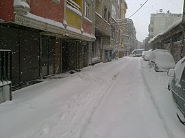 Sultangazi in winter (2012) | |
Logo | |
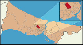 Map showing Sultangazi District in Istanbul Province | |
 Sultangazi Location in Turkey 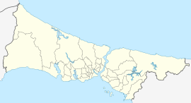 Sultangazi Sultangazi (Istanbul) | |
| Coordinates: 41°5′57″N 28°52′05″E / 41.09917°N 28.86806°E | |
| Country | Turkey |
| Province | Istanbul |
| Government | |
| • Mayor | Abdurrahman Dursun (AKP) |
| Area | 37 km2 (14 sq mi) |
| Population (2022)[1] | 542,531 |
| • Density | 15,000/km2 (38,000/sq mi) |
| Time zone | UTC+3 (TRT) |
| Postal code | 34260, 34265, 34270 |
| Area code | 0212 |
| Website | www |
In 2008 the district Sultangazi was created from parts of the districts Gaziosmanpaşa, Eyüpsultan and Esenler.[4][5] The name of "Sultangazi" comes from "Sultan" word part of Sultançiftliği (meaning farm of the Sultan) and the neighbourhood of Gazi, with "gazi" the Turkish for a venerated veteran of war.
This district's population comprises many ethnic minorities, including immigrants from Bulgaria and the former Yugoslavia, the Black Sea region of Turkey, Kurds and Alevis, as well as Turks. Kurdish minority and Alevi people are mostly found in the Gazi neighbourhood, which has become infamous in Turkey after the 1995 riots.
Composition edit
There are 15 neighbourhoods in Sultangazi District:[6]
- 50. Yıl
- 75. Yıl
- Cebeci
- Cumhuriyet
- Esentepe
- Eski Habipler
- Gazi
- Habibler
- İsmet Paşa
- Malkoçoğlu
- Sultançiftliği
- Uğur Mumcu
- Yayla
- Yunus Emre
- Zübeyde Hanım
See also edit
References edit
- ^ a b "Address-based population registration system (ADNKS) results dated 31 December 2022, Favorite Reports" (XLS). TÜİK. Retrieved 12 July 2023.
- ^ Büyükşehir İlçe Belediyesi, Turkey Civil Administration Departments Inventory. Retrieved 12 July 2023.
- ^ "İl ve İlçe Yüz ölçümleri". General Directorate of Mapping. Retrieved 12 July 2023.
- ^ Kanun No. 5747, Resmî Gazete, 22 March 2008.
- ^ "İl İdaresi ve Mülki Bölümler Şube Müdürlüğü İstatistikleri - İl ve İlçe Kuruluş Tarihleri" (PDF) (in Turkish). p. 43. Retrieved 26 July 2023.
- ^ Mahalle, Turkey Civil Administration Departments Inventory. Retrieved 12 July 2023.