


Summary
Parangipettai (/peɪɑːreɪaɪpiteɪaɪ/ ⓘ Pa-re-gi-Pe-Tie), historically called Porto Novo ("New Port" in Portuguese), is a coastal panchayat town in Cuddalore district in the Indian state of Tamil Nadu. Parangipettai is located on the north bank of the mouth of the Vellar River at a distance of 30 km from Cuddalore. From the state capital city of Chennai, Parangipettai can be reached through the National Highway NH32 stretch between Cuddalore and Chidambaram.
Parangipettai
Porto Novo | |
|---|---|
Town Panchayath | |
    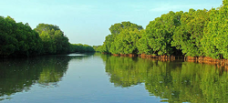 Top: Parangipettai Lighthouse, Sea Port Mid: Samiyarpettai Beach, CASMB Bottom: Pichavaram Forest | |
| Nickname(s): Mahmood Bundar, Muthukrishna Puri, Varunapuri | |
 Parangipettai ParangipettaiCoordinates: .mw-parser-output .geo-default,.mw-parser-output .geo-dms,.mw-parser-output .geo-dec{display:inline}.mw-parser-output .geo-nondefault,.mw-parser-output .geo-multi-punct,.mw-parser-output .geo-inline-hidden{display:none}.mw-parser-output .longitude,.mw-parser-output .latitude{white-space:nowrap}11°29′N 79°46′E / 11.49°N 79.76°E | |
| Country | |
| State | Tamil Nadu |
| District | Cuddalore |
| Taluk | Bhuvanagiri |
| Constituency | Chidambaram |
| Government | |
| • Type | Rural/Town |
| • Body | Union Town Panchayath |
| • Leader | Mrs. Thenmozhli Shankar (DMK) |
| • MLA | Mr. K. A. Pandian (AIADMK) |
| • MP | Mr. Thol. Thirumavalavan (VCK) |
| • District Collector | Mr. A. Arun Thamburaj, I.A.S |
| Area | |
| • Total | 11.81 km2 (4.56 sq mi) |
| Elevation | 12 m (39 ft) |
| Population (2011)[1] | |
| • Total | 25,541 |
| • Density | 2,200/km2 (5,600/sq mi) |
| Demonym(s) | Parangiars, Novians |
| languages | |
| • Official | Tamil, English |
| • Local | Tamil, English, Urudu |
| Time zone | UTC+5:30 (IST) |
| PIN | 608502 |
| Telephone code | 04144 |
| Website | https://parangipettai.com |
Its strategic location on the Coromandel Coast has long made it a major trading center. In particular, it was an important trading destination for the Arabs, especially the Yemenis. During the colonial era, the Portuguese, the Dutch and the English successively colonized the area.
There is also a Gandhian connection to Parangipettai. Anne Marie Petersen became in 1909 a missionary in the so-called Loventhal Mission. The foundation stone was laid by Mahatma Gandhi himself in 1921, and a few years later, the school was officially opened under the name Seva Mandir at a place called Porto Novo, near Chidambaram, in Tamil Nadu, South India.
Today, Parangipettai has evolved into a well-developed town with nearly all necessities such as healthcare, education and transport. It also hosts a marine biology station that is affiliated with the Annamalai University.
The town is an important pilgrimage center for Muslims and Hindus.
Etymology edit


Throughout history, Parangipettai has taken many different names. Parangipettai is mentioned in classical Tamil literature as Varunapuri, meaning the place where the rain god Varuna had worshipped Lord Shiva. During Nayyakar rule, it was renamed Muthukrishna Puri and then Mahmood Banthar during Mughal rule. The Portuguese, during their rule, named the place "Porto Novo", which means "New Port" in Portuguese, because they set up a port here and made it their trading stronghold.
The town is now known as Parangipettai. In Tamil, the word parangiar refers to Europeans, and pettai means place. Thus, Parangipettai translates to the "abode of the parangiars or "Europeans" in Tamil.[2]
History edit
Muslims prominently sunni islam living in Parangipettai claimed to have a unique African Arabian ancestry. Tamil is their mother tongue but it has been heavily influenced by Persian and Arabic. Previously, especially during the Tamil Chola rule of Tamil Nadu, Arab traders used to heavily trade around the Coromandel coast in which Parangipettai is located. Some traders claimed, throughout time decided to settle down here.
In 1733, the Swedish East India Company established a factory in Porto Novo though after a month it was destroyed by the British and the French.[3]
In 1801, Sir George Leith, who was then Lieutenant Governor of Penang, Malaysia, appointed a prominent Indian Muslim Boatman, Cauder Mohudeen, a Christian reconvert, as Captain of the South Indian "Keling" sect. He granted a piece of land to build a mosque on the south side of Malabar Street (Chulia Street) in Penang, Malaysia. The mosque is now known as Yusof Kapittan Mosque but needs more evidence for the claims as per verdict issued by Malaysian Courts. Cauder Mohudeen (born c. 1759) is said to be a small boat mandoor or foreman from Parangipettai in local chats.
The Battle of Porto Novo was fought here in 1781 during the Second Anglo-Mysore War. The conflict pitted the forces of the Kingdom of Mysore under Karim Khan Sahib, accompanied by his father Hyder Ali, against forces belonging to the British East India Company under Sir Eyre Coote. Though they were outnumbered 5 to 1, the British prevailed.
The town flourished as a seaport with connections to southeast Asia and as an industrial center during British rule, when iron made here was exported to England. The powerful Nawabs of Arcot had his mint at Porto Novo and the gold coins struck in this mint came to be called the Porto Novo Pagoda. Later the English followed the same design when they minted the 'Negapatam' (Nagapatnam) Pagoda; the Dutch minted their coin in the same design at Tuticorin and Colombo mints.[2]
Climate edit
The Parangipettai has heavy rainfall during the northeast monsoon. The total annual rainfall usually ranges between 1,200 and 1,400 mm.[4] This place is still known for its frequent rainfall. "Parangipettai in Tamil Nadu became the rainiest city in India with 168 mm of rainfall," says Skymet Weather.[5] In November 2023, Parangingipettai was second place in District rainfall recorded with 119.5 mm in 24h.[6]
| Climate data for Parangipettai (Porto Novo) 1981–2010, extremes 1968–2011 | |||||||||||||
|---|---|---|---|---|---|---|---|---|---|---|---|---|---|
| Month | Jan | Feb | Mar | Apr | May | Jun | Jul | Aug | Sep | Oct | Nov | Dec | Year |
| Record high °C (°F) | 33.0 (91.4) |
35.5 (95.9) |
39.9 (103.8) |
41.5 (106.7) |
43.5 (110.3) |
42.5 (108.5) |
40.5 (104.9) |
39.5 (103.1) |
46.0 (114.8) |
38.0 (100.4) |
37.3 (99.1) |
36.4 (97.5) |
46.0 (114.8) |
| Mean daily maximum °C (°F) | 29.2 (84.6) |
30.3 (86.5) |
32.3 (90.1) |
34.7 (94.5) |
37.3 (99.1) |
37.5 (99.5) |
36.1 (97.0) |
35.4 (95.7) |
34.4 (93.9) |
32.3 (90.1) |
29.8 (85.6) |
29.0 (84.2) |
33.2 (91.8) |
| Mean daily minimum °C (°F) | 20.6 (69.1) |
21.1 (70.0) |
23.0 (73.4) |
25.3 (77.5) |
26.2 (79.2) |
26.1 (79.0) |
25.3 (77.5) |
24.8 (76.6) |
24.6 (76.3) |
24.0 (75.2) |
22.7 (72.9) |
21.4 (70.5) |
23.8 (74.8) |
| Record low °C (°F) | 14.0 (57.2) |
14.0 (57.2) |
17.8 (64.0) |
18.8 (65.8) |
19.0 (66.2) |
19.3 (66.7) |
18.7 (65.7) |
18.6 (65.5) |
17.8 (64.0) |
17.0 (62.6) |
16.5 (61.7) |
14.5 (58.1) |
14.0 (57.2) |
| Average rainfall mm (inches) | 39.1 (1.54) |
42.1 (1.66) |
32.4 (1.28) |
17.9 (0.70) |
37.8 (1.49) |
43.0 (1.69) |
65.4 (2.57) |
87.9 (3.46) |
118.0 (4.65) |
259.4 (10.21) |
433.0 (17.05) |
238.6 (9.39) |
1,414.5 (55.69) |
| Average rainy days | 1.9 | 1.4 | 0.4 | 0.8 | 1.5 | 2.8 | 3.9 | 4.8 | 5.1 | 9.5 | 11.5 | 6.4 | 50.0 |
| Average relative humidity (%) (at 17:30 IST) | 76 | 75 | 75 | 74 | 70 | 61 | 63 | 66 | 71 | 77 | 81 | 78 | 72 |
| Source: India Meteorological Department[7][8] | |||||||||||||
Religion edit
In Parangipettai, various faiths live together in relative peace. Muslims and Hindus reside in the town in nearly equal numbers. Christians also live here. Among the Muslims are clans or family groups, but they necessarily affect social interactions like marriages and mutual living. Some of the Muslims are the Maraicars, Sahibs, Ravuthtars and Pattans. The most common ones are Maraicar. Maraicar the name faded claims to have derived from the old Tamil term 'Marakkalangalin aayargal' meaning 'Kings of Boats', a title said to be given by the Southern Tamil Hindu King Vijaya Raghunadha Sedhupathy Thondamaan (King Sethu) to the Arab traders from parts of Shia Yemen and Sunni Arabia, now Saudi Arabia, who and were the reigning members of coastal trade with those regions.[11]
At 2011 census, Parangipettai had a population of 1,10,073, with males constituting 50.23% of the population and females 49.77%.
It has a religious practice Hinduism average of 56.34%, at second place Islam average of 42.69%, then Christianity average is 0.47%, Jainism is 0.07% and others or not stated 0.43%.[10]
Book edit

The First and only book about the Muslims of Parangipettai was written in Tamil and published by Jenifah Academy in December 2017. Named "Mahmoodbandar Parangipettai Muslimgal - Oru Paarvaiyum pathivum", this is the only known record about the Muslims of Parangipettai, their History, Culture, lifestyles, etc.
The first book of their history spanning more than a thousand years and their contemporary lives titled "Mahmoodbandar Parangipettai Muslims - A View and Record" was released on 23.12.2017 at Parangipettai Mahmoodiah Shaadi Mahaal. The author of the book is L. Hameed Maraicar.[12]
The author of the book L. Hameed Maraicar In his speech, described his dream for this book and how the endeavor began. In 1998, when he moved back to this town, he explained the difficulties he faced in the creation of this book, from traveling with his friends on a bicycle to learning about the living conditions of Muslims in the nearby villages of Parangipettai.
Demographics edit
| Population of Parangipettai 1871 - 2011 | |||||
|---|---|---|---|---|---|
| Census Year | No. of Village Panchayats | Total Population | Total Male | Total Female | Under 6 years of Age |
| 1871[13] | T | 7,182 | * | * | * |
| 1881[14] | T | 7,823 | 3,122 | 4,701 | * |
| 1891[15] | T | 14,061 | 6,190 | 7,871 | * |
| 1901[16] | T | 13,712 | 5,957 | 7,755 | * |
| 1911[17] | T | 15,804 | 7,232 | 8,572 | * |
| 1921[18] | T | 12,940 | 6,021 | 6,019 | * |
| 1931[19] | T | 13,762 | 6,329 | 7,433 | ~1,820 |
| 1941[20] | T | 14,145 | 6,624 | 7,521 | * |
| 1951[21] | TP | 15,084 | 6,874 | 8,210 | * |
| 1961[22] | TP | 15,139 | 7,078 | 8,061 | * |
| 1971[23] | TP | 17,412 | 7,917 | 9,495 | * |
| 1981[24] | TP | 20,100 | 9,079 | 11.021 | * |
| 1991[25] | TP | 23,550 | 10,890 | 12,660 | 2,716 |
| 2001[26] | 57[27] | 20,901 | 10,178 | 10,723 | 2,457 |
| 2011[1] | 41[28] | 25,541 | 12,733 | 12,808 | 3,022 |
| Source: Census of India & Directorate of Census Operations of Tamil Nadu | |||||
At 2001 Census edit
Parangipettai had a population of 20,901, with males constituting 49% of the population and females 51%. In Parangipettai, 12% of the population is under 6 years of age. Parangipettai has an average literacy rate of 75%, higher than the national average of 59.5%: male literacy is 81%, and female literacy is 69%. [29]
At 2011 Census edit
Parangipettai had a population of 1,10,073, with males constituting 50.23% of the population and females 49.77%. In Parangipettai, 11.25% of the population is under 6 years of age.[30]
Parangipettai has an average literacy rate of 70.45%, Lower than the national average of 73.5%: male literacy is 76.21%, and female literacy is 64.64%.[31]
| Year | Population (% change from prior Census) |
|---|---|
| 1871 | 7,182
|
| 1881 | 7,823(+8.9%)
|
| 1891 | 14,061(+79.7%)
|
| 1901 | 13,712(-2.4%)
|
| 1911 | 15,804(+15.3%)
|
| 1921 | 12,940(-18.1%)
|
| 1931 | 13,762(+6.4%)
|
| 1941 | 14,175(+3.0%)
|
| 1951 | 15,084(+6.4%)
|
| 1961 | 15,139(+0.4%)
|
| 1971 | 17,412(+15.0%)
|
| 1981 | 20,100(+15.4%)
|
| 1991 | 23,550(+17.2%)
|
| 2001 | 20,912(-11.2%)
|
| 2011 | 25,541(+12.2%)
|
| Census | Literacy rate | Illiteracy rate | ||||||||||
|---|---|---|---|---|---|---|---|---|---|---|---|---|
| Year | Average Literate | Total Literate | Male | Female | No. of Male | No. of Female | Average Illiterate | Total Illiterate | Male | Female | No. of Male | No. of Female |
| 1991 | 64.23% | 15,128 | 72.23% | 57.36% | 7,866 | 7,262 | 35.77% | 8,422 | 27.77% | 42.64% | 3,024 | 5,398 |
| 2001 | 74.88% | 15,651 | 80.92% | 69.15% | 8,236 | 7,415 | 25.12% | 5,250 | 19.08% | 30.85% | 1,942 | 3,308 |
| 2011 | 77.71% | 19,850 | 80.92% | 74.53% | 10,304 | 9,546 | 22.29% | 5,691 | 19.08% | 25.47% | 2,429 | 3,262 |
| Source: Census of India | ||||||||||||
Economy edit
Historically, Parangipettai was a trading port, and it now contributes around 3.5% of the state's total fish catch, which is distributed to various districts and other states in the country. Seafood is also exported to other countries overseas. Among the major seafood merchants from the place is SeaFoods Ltd., with a well-connected marketing network around the world.[35]
The production of a kind of extremely soft mat by Labbai's women, which is used for sleeping and as a hold-all for clothing and bedding, is the sole notable in Porto Novo. These are produced from the screw-pine (Pandanus odoratissimus) leaves are claimed to be copies of those formerly manufactured in Achin. even though it is generally accepted that their original quality has been much excelled in both color and texture.[36]
Transport edit
Railways edit

Parangipettai Railway Station (Code: PO) is a Very Important Station Historically and Economically. During the British rule in Parangipettai and about 15 years after the independence of the country, the railway transport was good. After the modernization of transport facilities, Parangipettai was left very backward.
After conversion to broad gauge, only 6 trains bound for Villupuram and Mayiladuthurai, in addition to two for Bangalore - Karaikal, a total of 8 trains stop at Parangipettai. Not one of the more than 60 express trains that pass through Parangipettai stops here.
Ship edit
This port carries on a busy trade with Ceylon, Acheng, Penang and Singapore. Steamers of the British India Steam Navigation Company (BISN) anchor 2 miles offshore in 4 1/2 to 5 feet of water and sail to Singapore once a fortnight. Goods are shipped and landed at the Government Jetty opposite the Custom House, where about twenty boats are available.[37] [38]
Places edit
Parangipettai Water Sports Complex edit
The Cuddalore District Administration is very keen to develop tourism activities at Parangipettai, a coastal town situated remotely right on the seashore, northern bank of the Vellar estuary. The Sub-Collector, Chidambaram, on his routine visit to Parangipettai, identified the Vellar estuary as a suitable place for the operation of Water sports activities. Incidentally, the Centre of Advanced Study in Marine Biology of Annamalai University, Chidambaram has already established an Aquatic Adventurous water sports facility under the aegis of University Grants Commission (India) to cater to the needs of students at Parangipettai campus since 2009.

On the direction of the Sub-collector, the CAS in Marine Biology, the Faculty of Marine Sciences conceived the idea and drafted the proposal for setting up of Water sports complex and later got approved by the District Administration. Subsequently, Annamalai University entered into MoU with Parangipettai Town Panchayat to operate Water sports for the general public in Vellar backwaters, flowing right in front of the Centre of Advanced Study in Marine Biology campus, on revenue revenue-sharing basis. As per the terms and conditions of the MoU, Parangipettai town Panchayat is responsible for extending basic infrastructure for 58.80 lakhs. [39]
Hyder Ali War location edit
The Battle of Porto Novo was fought on 1 July 1781 between forces of the Kingdom of Mysore and British East India Company in the place called Porto Novo (now known as Parangipettai) on the Indian subcontinent, during the Second Anglo-Mysore War. The British force, numbering more than 8,000 men under the command of Sir Eyre Coote defeated a force estimated at 40,000 under the command of Hyder Ali.[40][41][42]

edit
Portonovo Lighthouse cum Navtex Station (Parangipettai) was established by Government of India in the year of 1980, Parangipettai is located on the north bank of the mouth of the Vellar River at a distance of 30 km from Cuddalore.

The popular Temple of “Thillai Natarajer” in Chidambaram is located about 18 km from Portonovo lighthouse. Parangipettai has evolved into a well-developed town with nearly all basic necessities such as healthcare, education and transport.
It also hosts a Biology Station affiliated with the Annamalai University.[43]
References edit
- ^ a b "POPULATION CENSUS_ 2011 FOR VILLAGE PANCHAYATS AND PANCHAYAT UNIONS" (PDF). Published by DIRECTORATE OF CENSUS OPERATIONS of Tamilnadu. PDF Pg. No. 35
- ^ a b Prof. Dr. M. Srinivasan and Dr. A. C. Ratheesh (February 2019). Parampariyam Miguntha Parangipettai. Environmental Information Center CASMB Annamalai University.
- ^ "Porto Novo". Nordisk familjebok (in Swedish). Retrieved 2 December 2018.
- ^ Perumal .P (1993). The influence of meteorological phenomena on the ecosystems of a tropical region, southeast coast of India: A case study. Vol. 19, No. 3, 343–351, Ciencias Mankas.
- ^ "Heavy rain lashes Chennai". The New Indian Express. 8 November 2021.
- ^ "Tamil Nadu Rains". The Hindu. 16 November 2023.
- ^ "Station: Port Novo Climatological Table 1981–2010" (PDF). Climatological Normals 1981–2010. India Meteorological Department. January 2015. pp. 621–622. Archived from the original (PDF) on 5 February 2020. Retrieved 29 March 2020.
- ^ "Extremes of Temperature & Rainfall for Indian Stations (Up to 2012)" (PDF). India Meteorological Department. December 2016. p. M201. Archived from the original (PDF) on 5 February 2020. Retrieved 29 March 2020.
- ^ "Table C-01 Population by Religion: Tamil Nadu". censusindia.gov.in. Registrar General and Census Commissioner of India. 2011.
- ^ a b "Parangipettai Population Religion Data". Census Commission of India. 2011.
- ^ Rājāmukamatu, Je (2005). Maritime History of the Coromandel Muslims: A Socio-historical Study on the Tamil Muslims 1750-1900. Chennai, India: Director of Museums, Government Museum.
- ^ "மஹ்மூத்பந்தர் பரங்கிப்பேட்டை முஸ்லிம்கள் – ஒரு பார்வையும் பதிவும்… நூல் வெளியீட்டு விழா".Published by Jenifah Academy on 23/12/2017. Author - L. Hameed Maraicar.
- ^ "Statement of Population of 1871 in Each Village of the South Arcot District" (PDF). Published by GANTZ BROTHERS, AT THE ADELPHI PRESS, MOUNT ROAD, MADRAS. PDF Pg. No. 217
- ^ "Imperial census : operations and results in the Presidency of Madras,1881". Published by GANTZ BROTHERS, AT THE ADELPHI PRESS, MOUNT ROAD, MADRAS. Book Pg. No. 433
- ^ "Census of India. Volume XIV, Madras : tables I to XVII-C, British territory, 1891". Published by SUPERINTENDENT GOVERNMENT PRESS, MADRAS. Book Pg. No. 9
- ^ "Census of India, Vol. XV-A: Madras Part II, 1901". Published by SUPERINTENDENT GOVERNMENT PRESS, MADRAS. PDF Pg. No. 17
- ^ "IMPERIAL AND PROVINCIAL TABLES, Madras. Part II, Vol-XII, 1911" (PDF). Published by SUPERINTENDENT GOVERNMENT PRESS, MADRAS. PDF Pg. No. 13
- ^ "VILLAGE STATISTICS SOUTH ARCOT DISTRICT, 1921" (PDF). Published by THE SUPERINTENDENT, GOVERNMENT PRESS, MADRAS. PDF Pg. No. 8
- ^ "Provincial Tables, Part III, Vol-XIV,1931" (PDF). Superintendent of Census Operations, Madras.PDF Pg. No.30
- ^ "VILLAGE STATISTICS SOUTH ARCOT DISTRICT, 1941" (PDF). Published by SUPERINTENDENT GOVERNMENT PRESS, MADRAS. PDF Pg. No. 3
- ^ "Census Handbook, South Arcot, 1951" (PDF). Published by SUPERINTENDENT GOVERNMENT PRESS, MADRAS. PDF Pg. No. 27
- ^ "District Census Handbook, South Arcot, Part X-III, Vol-II, Vol-IX, 1961" (PDF). Published by SUPERINTENDENT OF CENSUS Operations, MADRAS. PDF Pg. No. 463-465
- ^ "Administrative Atlas, Part IX-A, Vol-I, Series-19, 1971" (PDF). Published by DIRECTOR OF CENSUS OPERATIONS TAMIL NADU AND PONDICHERRY. PDF Pg. No. 120
- ^ "Final Population Totals of Tamil Nadu, 1981" (PDF). Published by Director of Census Operation Tamil Nadu. PDF Pg. No. 51
- ^ "Final Population of Tamil Nadu, 1991" (PDF). Published by DIRECTORATE OF CENSUS OPERATIONS, Tamilnadu. PDF Pg. No.147
- ^ "POPULATION CENSUS_ 2001 FOR VILLAGE PANCHAYATS AND PANCHAYAT UNIONS". Published by Census Commission of India. Archived from the original on 16 June 2004. PDF Pg. No. 484-485
- ^ "Census of India 2001 - Series 17 - District Census Handbook Tamil Nadu, Part A & B - Cuddalore" (PDF). Published by Census of India 2001 - District Census Handbook Tamil Nadu, Cuddalore.
- ^ "No.of Parangipettai Village Panchayaths" (PDF). Published by Cuddalore District Collectorate Office.
- ^ "Census of India 2001: Data from the 2001 Census, including cities, villages and towns (Provisional)". Census Commission of India. Archived from the original on 16 June 2004. Retrieved 1 November 2008.
- ^ "POPULATION CENSUS_ 2011 FOR VILLAGE PANCHAYATS AND PANCHAYAT UNIONS" (PDF). Published by DIRECTORATE OF CENSUS OPERATIONS of Tamilnadu.
- ^ "DISTRICT CENSUS HANDBOOK 2011, CUDDALORE" (PDF). Published by DIRECTORATE OF CENSUS OPERATIONS of Tamilnadu.
- ^ "Statement of Population of 1871 in Each Village of the South Arcot District" (PDF). Published by GANTZ BROTHERS, AT THE ADELPHI PRESS, MOUNT ROAD, MADRAS. PDF Pg. No. 217
- ^ "DISTRICT CENSUS HANDBOOK TAMIL NADU, PART A & B - CUDDALORE,2001" (PDF). Director of Census Operations, Tamil Nadu.PDF Pg. No.484-485
- ^ "DISTRICT CENSUS HANDBOOK CUDDALORE, 2011" (PDF). DIRECTORATE OF CENSUS OPERATIONS TAMIL NADU.Pg. No.28
- ^ Kaja Nazimudeen (14 March 2017). "தொட்டு விடும் தூரம்". Portonovocomputertech.blogspot.com. Retrieved 25 June 2017.
- ^ Francis W (1906). South Arcot District Gazetteers.
- ^ Ltd, South Indian Railway Company (15 July 2015). The Illustrated Guide to the South Indian Railway. Amberley Publishing Limited. ISBN 978-1-4456-5082-1 – via Google Books.
- ^ Dr. V. Palanichamy (2007). French Trade In Porto Novo A.D. 1673-1780.
- ^ "Parangipettai Water Sports Complex".
- ^ Malleson, George Bruce (1914). The Decisive Battles of India: from 1746 to 1849. Reeves & Turner. p. 254.
- ^ Barua, Pradeep. The state at war in South Asia, pp. 80–81.
- ^ *Garstin, John Henry. Manual of the South Arcot district, pp. 152–154.
- ^ "Portonovo Lighthouse And Navtex Station". Established & Maintaining by Directorate of Lighthouses and Lightships, Ministry of Ports, Government of India.
External links edit
- Business & Service Listing of Parangipettai
- PortoNovo Payaniyar Nala Sangam - பரங்கிப்பேட்டை பயணியர் நலச்சங்கம்
- Encyclopedia of Parangipettai
- PSAO - Parangipettai Social Activities Organization
- LEAP - Learning & Educational Academy of Portonovo
- தர்மம் செய்வோம் குழுமம், பரங்கிப்பேட்டை
- Parangipettai.tripod.com
- Latest Parangipettai News
- Porto-Novo.in
- Parangipettai Memes
- Novians Google Group
- Oor Sethi - Local Tamil News App. Oor Sethi App Developed by Parangipettai Tech people.