


Summary
Morelos is a state in South Central Mexico that is currently divided into 36 municipalities. According to the 2020 Mexican census, it is the twenty-third most populated state with 1,971,520 inhabitants and the third smallest by land area spanning 4,878.9 square kilometres (1,883.8 sq mi).[1][2]


Municipalities in Morelos are administratively autonomous of the state according to the 115th article of the 1917 Constitution of Mexico.[3] Every three years, citizens elect a municipal president (Spanish: presidente municipal) by a plurality voting system who heads a concurrently elected municipal council (ayuntamiento) responsible for providing all the public services for their constituents. The municipal council consists of a variable number of trustees and councillors (regidores y síndicos).[4] Municipalities are responsible for public services (such as water and sewerage), street lighting, public safety, traffic, and the maintenance of public parks, gardens and cemeteries.[5] They may also assist the state and federal governments in education, emergency fire and medical services, environmental protection and maintenance of monuments and historical landmarks. Since 1984, they have had the power to collect property taxes and user fees, although more funds are obtained from the state and federal governments than from their own income.[5]
The largest municipality by population is Cuernavaca, with 378,476 residents (19.19% of the state population), while the smallest is Tetecala with 7,617 residents.[1] The largest municipality by land area is Tlaquiltenango which spans 543.90 km2 (210.00 sq mi), and the smallest is Hueyapan with 19.20 km2 (7.41 sq mi).[2] On November 9, 2017, the state legislature approved the creation of four indigenous municipalities (Coatetelco, Xoxocotla, Hueyapan and Tetelcingo), effective on January 1, 2019.[6][7][8] However, due to objections by authorities in Cuautla, it was decided on July 26, 2018 that Tetelcingo would not be included in the list of new municipalities.[9][10]
Municipalities edit
- Largest municipalities in Morelos by population
-
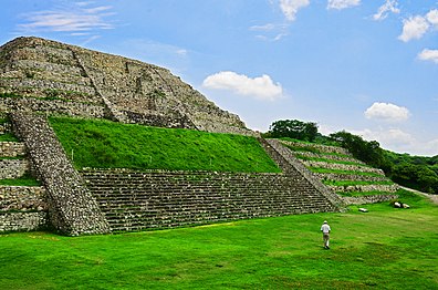
 Cuernavaca, largest municipality by population in Morelos.
 -
 Jiutepec, second largest municipality by population.
 -
 Cuautla, third largest municipality by population.
 -
 Temixco, fourth largest municipality by population.


| Name | Municipal seat | Population (2020)[1] |
Population (2010)[11] |
Change | Land area[2] | Population density (2020) |
Incorporation date[12] | |
|---|---|---|---|---|---|---|---|---|
| km2 | sq mi | |||||||
| Amacuzac | Amacuzac | 17,598 | 17,021 | +3.4% | 117.2 | 45.3 | 150.2/km2 (388.9/sq mi) | May 13, 1868 |
| Atlatlahucan | Atlatlahucan | 25,232 | 18,895 | +33.5% | 79.4 | 30.7 | 317.8/km2 (823.1/sq mi) | December 18, 1932 |
| Axochiapan | Axochiapan | 39,174 | 33,695 | +16.3% | 141.5 | 54.6 | 276.8/km2 (717.0/sq mi) | November 12, 1898 |
| Ayala[a] | Ciudad Ayala | 89,834 | 78,866 | +13.9% | 368.3 | 142.2 | 243.9/km2 (631.7/sq mi) | May 13, 1868 |
| Coatetelco[b] | Coatetelco | 11,347 | — | — | 51.6 | 19.9 | 219.9/km2 (569.5/sq mi) | January 1, 2019 |
| Coatlán del Río | Coatlán del Río | 10,520 | 9,471 | +11.1% | 83.4 | 32.2 | 126.1/km2 (326.7/sq mi) | July 31, 1861 |
| Cuautla | Cuautla | 187,118 | 175,207 | +6.8% | 121.9 | 47.1 | 1,535.0/km2 (3,975.7/sq mi) | August 6, 1824 |
| Cuernavaca | Cuernavaca† | 378,476 | 365,168 | +3.6% | 199.7 | 77.1 | 1,895.2/km2 (4,908.6/sq mi) | August 6, 1824 |
| Emiliano Zapata | Emiliano Zapata | 107,053 | 83,485 | +28.2% | 68.3 | 26.4 | 1,567.4/km2 (4,059.5/sq mi) | December 18, 1932 |
| Hueyapan[c] | Hueyapan | 7,855 | — | — | 19.2 | 7.4 | 409.1/km2 (1,059.6/sq mi) | January 1, 2019 |
| Huitzilac | Huitzilac | 24,515 | 17,340 | +41.4% | 189.1 | 73.0 | 129.6/km2 (335.8/sq mi) | August 29, 1921 |
| Jantetelco | Jantetelco | 18,402 | 15,646 | +17.6% | 102.3 | 39.5 | 179.9/km2 (465.9/sq mi) | 1826 |
| Jiutepec | Jiutepec | 215,357 | 196,953 | +9.3% | 55.9 | 21.6 | 3,852.5/km2 (9,978.0/sq mi) | 1826 |
| Jojutla | Jojutla | 57,682 | 55,115 | +4.7% | 149.0 | 57.5 | 387.1/km2 (1,002.7/sq mi) | March 29, 1847 |
| Jonacatepec | Jonacatepec de Valle | 16,694 | 14,604 | +14.3% | 90.3 | 34.9 | 184.9/km2 (478.8/sq mi) | January 29, 1825 |
| Mazatepec | Mazatepec | 9,653 | 9,456 | +2.1% | 57.9 | 22.4 | 166.7/km2 (431.8/sq mi) | December 16, 1848 |
| Miacatlán[d] | Miacatlán | 15,802 | 24,990 | −36.8% | 162.6 | 62.8 | 97.2/km2 (251.7/sq mi) | 1826 |
| Ocuituco | Ocuituco | 19,219 | 16,858 | +14.0% | 86.5 | 33.4 | 222.2/km2 (575.5/sq mi) | 1826 |
| Puente de Ixtla[e] | Puente de Ixtla | 40,018 | 61,585 | −35.0% | 237.2 | 91.6 | 168.7/km2 (437.0/sq mi) | 1826 |
| Temixco | Temixco | 122,263 | 108,126 | +13.1% | 102.8 | 39.7 | 1,189.3/km2 (3,080.3/sq mi) | March 5, 1933 |
| Temoac | Temoac | 16,574 | 9,087 | +82.4% | 37.1 | 14.3 | 446.7/km2 (1,157.0/sq mi) | March 17, 1977 |
| Tepalcingo | Tepalcingo | 28,122 | 25,346 | +11.0% | 368.6 | 142.3 | 76.3/km2 (197.6/sq mi) | 1826 |
| Tepoztlán | Tepoztlán | 54,987 | 41,629 | +32.1% | 242.4 | 93.6 | 226.8/km2 (587.5/sq mi) | 1826 |
| Tetecala | Tetecala | 7,617 | 7,441 | +2.4% | 67.7 | 26.1 | 112.5/km2 (291.4/sq mi) | 1826 |
| Tetela del Volcán[f] | Tetela del Volcán | 14,853 | 19,138 | −22.4% | 79.3 | 30.6 | 187.3/km2 (485.1/sq mi) | January 31, 1937 |
| Tlalnepantla | Tlalnepantla | 7,943 | 6,636 | +19.7% | 107.9 | 41.7 | 73.6/km2 (190.7/sq mi) | October 11, 1848 |
| Tlaltizapán | Tlaltizapán | 52,399 | 48,881 | +7.2% | 238.5 | 92.1 | 219.7/km2 (569.0/sq mi) | 1826 |
| Tlaquiltenango | Tlaquiltenango | 33,789 | 31,534 | +7.2% | 543.9 | 210.0 | 62.1/km2 (160.9/sq mi) | 1826 |
| Tlayacapan | Tlayacapan | 19,408 | 16,543 | +17.3% | 57.2 | 22.1 | 339.3/km2 (878.8/sq mi) | 1826 |
| Totolapan | Totolapan | 12,750 | 10,789 | +18.2% | 60.0 | 23.2 | 212.5/km2 (550.4/sq mi) | 1826 |
| Xochitepec | Xochitepec | 73,539 | 63,382 | +16.0% | 93.2 | 36.0 | 789.0/km2 (2,043.6/sq mi) | 1826 |
| Xoxocotla[g] | Xoxocotla | 27,805 | — | — | 61.7 | 23.8 | 450.6/km2 (1,167.2/sq mi) | January 1, 2019 |
| Yautepec | Yautepec de Zaragoza | 105,780 | 97,827 | +8.1% | 179.6 | 69.3 | 589.0/km2 (1,525.4/sq mi) | 1826 |
| Yecapixtla[h] | Yecapixtla | 56,083 | 46,809 | +19.8% | 173.2 | 66.9 | 323.8/km2 (838.7/sq mi) | 1826 |
| Zacatepec | Zacatepec de Hidalgo | 36,094 | 35,063 | +2.9% | 30.7 | 11.9 | 1,175.7/km2 (3,045.0/sq mi) | December 25, 1936 |
| Zacualpan | Zacualpan de Amilpas | 9,965 | 9,087 | +9.7% | 53.8 | 20.8 | 185.2/km2 (479.7/sq mi) | 1826 |
| Morelos | — | 1,971,520 | 1,777,227 | +10.9% | 4,878.9 | 1,883.8 | 404.1/km2 (1,046.6/sq mi) | — |
| Mexico | — | 126,014,024 | 112,336,538 | +12.2% | 1,960,646.7 | 757,010 | 64.3/km2 (166.5/sq mi) | — |
Notes edit
- ^ Ayala was originally incorporated as San José Mapaxtlán, changing its name on December 5, 1882.[12]
- ^ Coatetelco was created in 2019 out of Miacatlán, no population info for 2010.
- ^ Hueyapan was created in 2019 out of Tetela del Volcán, no population info for 2010.
- ^ The municipality of Coatetelco was created out of Miacatlán in 2019.
- ^ The municipality of Xoxocotla was created out of Puente de Ixtla in 2019.
- ^ The municipality of Hueyapan was created out of Tetela del Volcán in 2019.
- ^ Xoxocotla was created in 2019 out of Puente de Ixtla, no population info for 2010.
- ^ Yecapixtla was originally incorporated as Ayacapiztla, changing its name on June 2, 1849.[12]
References edit
- ^ a b c "Censo de Población y Vivienda 2020 - SCITEL" (in Spanish). INEGI. Retrieved January 27, 2021.
- ^ a b c "México en cifras - Medio Ambiente" (in Spanish). INEGI. Retrieved February 12, 2021.
- ^ "Constitución Política de los Estados Unidos Mexicanos". Article 115, of 1917 (in Spanish). Retrieved September 27, 2017.
- ^ OECD (November 12, 2004). New Forms of Governance for Economic Development. OECD Publishing. p. 121. ISBN 9264015329.
- ^ a b International Business Publications (2009). Mexico Company Laws and Regulations Handbook. p. 42. ISBN 978-1-4330-7030-3.
{{cite book}}:|last=has generic name (help) - ^ "Habrá a partir de 2019 4 municipios indígenas en Morelos". Diario de Morelos (in Spanish). November 9, 2017. Retrieved January 2, 2018.
- ^ "Publica el Periódico Oficial "Tierra y Libertad" decreto por el que se crea el municipio de Coatetelco" (in Spanish). Government of Morelos. December 14, 2017. Retrieved January 2, 2018.
- ^ "Se consolida el respeto a las comunidades indígenas en Morelos, Tetelcingo nuevo municipio" (in Spanish). Government of Morelos. December 26, 2017. Retrieved January 2, 2018.
- ^ "Sólo aprobaron a tres nuevos municipios indígenas" (in Spanish). La Jornada Morelos. July 26, 2018. Archived from the original on December 23, 2018. Retrieved December 22, 2018.
- ^ "Sólo son tres los nuevos municipios indígenas en Morelos" (in Spanish). En Serio Noticias. July 26, 2018. Retrieved December 22, 2018.
- ^ "Censo de Población y Vivienda 2010 - SCITEL" (in Spanish). INEGI. Retrieved January 27, 2021.
- ^ a b c Estado de Morelos División Territorial de 1810 a 1995 (PDF) (in Spanish). Mexico: INEGI. 1996. ISBN 970-13-1502-2.