


Summary
Mount Healthy is a city in Hamilton County, Ohio, United States. It is a suburb of Cincinnati. The population was 6,996 at the 2020 census.
Mount Healthy, Ohio | |
|---|---|
 | |
| Motto: "A city with a historic past working toward the future" | |
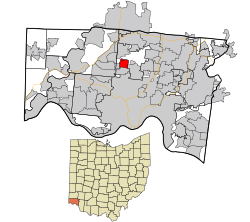 Location in Hamilton County and the state of Ohio | |
| Coordinates: 39°14′02″N 84°32′48″W / 39.23389°N 84.54667°W | |
| Country | United States |
| State | Ohio |
| County | Hamilton |
| Founded | 1817 (as Mount Pleasant) |
| Government | |
| • Mayor | Jennifer Moody[1] |
| Area | |
| • Total | 1.50 sq mi (3.87 km2) |
| • Land | 1.50 sq mi (3.87 km2) |
| • Water | 0.00 sq mi (0.00 km2) |
| Elevation | 837 ft (255 m) |
| Population (2020) | |
| • Total | 6,996 |
| • Estimate (2022)[4] | 6,871 |
| • Density | 4,679.60/sq mi (1,806.51/km2) |
| Time zone | UTC-5 (Eastern (EST)) |
| • Summer (DST) | UTC-4 (EDT) |
| ZIP code | 45231 |
| Area code | 513 |
| FIPS code | 39-52752[5] |
| GNIS feature ID | 1086221[3] |
| Website | www |
History edit
Mount Healthy was founded in 1817 as the village of Mount Pleasant.[6] In 1850, the village renamed itself "Mount Healthy", following a cholera epidemic, in which many of its citizens survived while those in the surrounding territory did not.[7] The village became a city in 1951.[8]
Geography edit
According to the United States Census Bureau, the city has a total area of 1.41 square miles (3.65 km2), all land.[9]
Demographics edit
| Census | Pop. | Note | %± |
|---|---|---|---|
| 1900 | 1,354 | — | |
| 1910 | 1,799 | 32.9% | |
| 1920 | 2,255 | 25.3% | |
| 1930 | 3,530 | 56.5% | |
| 1940 | 3,997 | 13.2% | |
| 1950 | 5,533 | 38.4% | |
| 1960 | 6,553 | 18.4% | |
| 1970 | 7,446 | 13.6% | |
| 1980 | 7,562 | 1.6% | |
| 1990 | 7,580 | 0.2% | |
| 2000 | 7,149 | −5.7% | |
| 2010 | 6,098 | −14.7% | |
| 2020 | 6,996 | 14.7% | |
| 2022 (est.) | 6,871 | −1.8% | |
| Sources:[5][10][11][12][13][14] | |||
2020 census edit
As of the census of 2020, there were 6,996 people living in the city, for a population density of 4,679.60 people per square mile (1,806.51/km2). There were 3,390 housing units. The racial makeup of the city was 42.8% White, 48.3% Black or African American, 0.2% Native American, 0.6% Asian, 0.0% Pacific Islander, 2.7% from some other race, and 5.5% from two or more races. 3.4% of the population were Hispanic or Latino of any race.[15]
There were 2,940 households, out of which 28.9% had children under the age of 18 living with them, 23.9% were married couples living together, 20.1% had a male householder with no spouse present, and 46.4% had a female householder with no spouse present. 39.4% of all households were made up of individuals, and 21.2% were someone living alone who was 65 years of age or older. The average household size was 2.31, and the average family size was 3.14.[15]
23.8% of the city's population were under the age of 18, 57.4% were 18 to 64, and 18.8% were 65 years of age or older. The median age was 39.7. For every 100 females, there were 92.3 males.[15]
According to the U.S. Census American Community Survey, for the period 2016-2020 the estimated median annual income for a household in the city was $41,389, and the median income for a family was $55,158. About 19.6% of the population were living below the poverty line, including 38.5% of those under age 18 and 13.2% of those age 65 or over. About 54.5% of the population were employed, and 16.6% had a bachelor's degree or higher.[15]
2010 census edit
As of the census[16] of 2010, there were 6,098 people, 2,716 households, and 1,454 families living in the city. The population density was 4,324.8 inhabitants per square mile (1,669.8/km2). There were 3,034 housing units at an average density of 2,151.8 per square mile (830.8/km2). The racial makeup of the city was 62.4% White, 33.0% African American, 0.2% Native American, 0.7% Asian, 0.1% Pacific Islander, 0.9% from other races, and 2.6% from two or more races. Hispanic or Latino of any race were 1.9% of the population.
There were 2,716 households, of which 27.7% had children under the age of 18 living with them, 31.4% were married couples living together, 17.2% had a female householder with no husband present, 4.9% had a male householder with no wife present, and 46.5% were non-families. 41.2% of all households were made up of individuals, and 17.5% had someone living alone who was 65 years of age or older. The average household size was 2.17 and the average family size was 2.97.
The median age in the city was 40 years. 22.9% of residents were under the age of 18; 8% were between the ages of 18 and 24; 25.3% were from 25 to 44; 25.8% were from 45 to 64; and 18.2% were 65 years of age or older. The gender makeup of the city was 44.9% male and 55.1% female.
2000 census edit
As of the census[5] of 2000, there were 7,149 people, 3,222 households, and 1,772 families living in the city. The population density was 5,022.2 inhabitants per square mile (1,939.1/km2). There were 3,421 housing units at an average density of 2,403.2 per square mile (927.9/km2). The racial makeup of the city was 73.70% White, 23.32% African American, 0.20% Native American, 0.49% Asian, 0.06% Pacific Islander, 0.60% from other races, and 1.64% from two or more races. Hispanic or Latino of any race were 1.02% of the population.
There were 3,222 households, out of which 28.2% had children under the age of 18 living with them, 36.3% were married couples living together, 15.3% had a female householder with no husband present, and 45.0% were non-families. 40.5% of all households were made up of individuals, and 18.1% had someone living alone who was 65 years of age or older. The average household size was 2.16 and the average family size was 2.93.
In the city the population was spread out, with 24.0% under the age of 18, 8.4% from 18 to 24, 30.4% from 25 to 44, 17.9% from 45 to 64, and 19.3% who were 65 years of age or older. The median age was 37 years. For every 100 females, there were 77.1 males. For every 100 females age 18 and over, there were 71.4 males.
The median income for a household in the city was $32,982, and the median income for a family was $41,753. Males had a median income of $31,783 versus $26,926 for females. The per capita income for the city was $18,662. About 6.8% of families and 8.9% of the population were below the poverty line, including 13.4% of those under age 18 and 11.4% of those age 65 or over.
Education edit
There are currently three schools within the actual city limits (one square mile): Mt. Healthy South Elementary School, Mt. Healthy North Elementary School, and Mount Healthy Jr./Sr. High School, which are all part of the Mt. Healthy City School District.[17] There is also the Mt. Healthy Preparatory and Fitness Academy which is a charter school.
Mount Healthy is served by a branch of the Public Library of Cincinnati and Hamilton County.[18]
Notable people edit
- Diyral Briggs – professional football linebacker, Green Bay Packers
- Alice Cary – poet
- Phoebe Cary – poet
- Robert S. Duncanson – first internationally known African-American artist
- Suzanne Farrell – American ballerina
- William Davis Gallagher – journalist and poet
- Oliver S. Glisson – Navy rear admiral
- Joel Heath – professional football nose tackle, Denver Broncos
- Paul Helms – baking industry executive and sports philanthropist
- Jeff Hill – professional football wide receiver, Cincinnati Bengals
- Nathaniel Dana Carlile Hodges – librarian
- Dummy Hoy – professional baseball center fielder, Cincinnati Reds
- Pee Wee Hunt – jazz trombonist, vocalist, and bandleader
- William H. MacKenzie – New York state assemblyman
- David Montgomery – professional football running back, Chicago Bears
- Elizabeth Nourse – realist painter
References edit
- ^ "Election Night Reporting". Hamilton County Board of Elections. Retrieved November 9, 2023.
- ^ "ArcGIS REST Services Directory". United States Census Bureau. Retrieved September 20, 2022.
- ^ a b U.S. Geological Survey Geographic Names Information System: Mount Healthy, Ohio
- ^ "QuickFacts Mount Healthy city, Ohio". United States Census Bureau. Retrieved September 26, 2023.
- ^ a b c "U.S. Census website". United States Census Bureau. Retrieved January 31, 2008.
- ^ "About Mt. Healthy". City of Mt. Healthy, Ohio. Archived from the original on March 29, 2014. Retrieved June 12, 2014.
- ^ "Guide to Clifton, College Hill/North College Hill, Mount Healthy and Northside". Cincinnati City Beat. August 27, 2013. Archived from the original on April 27, 2014. Retrieved June 12, 2014.
- ^ "Mt. Healthy History". Mt. Healthy Historical Society. Retrieved June 12, 2014.
- ^ "US Gazetteer files 2010". United States Census Bureau. Archived from the original on July 2, 2012. Retrieved January 6, 2013.
- ^ "Population: Ohio" (PDF). 1910 U.S. Census. U.S. Census Bureau. Retrieved November 28, 2013.
- ^ "Population: Ohio" (PDF). 1930 US Census. U.S. Census Bureau. Retrieved November 28, 2013.
- ^ "Number of Inhabitants: Ohio" (PDF). 18th Census of the United States. U.S. Census Bureau. 1960. Retrieved April 24, 2020.
- ^ "Ohio: Population and Housing Unit Counts" (PDF). U.S. Census Bureau. Retrieved November 22, 2013.
- ^ "Mount Healthy city, Ohio". census.gov. Retrieved July 5, 2022.
- ^ a b c d "Mount Healthy city, Ohio - Census Bureau Profile". United States Census Bureau. Retrieved October 2, 2023.
- ^ "U.S. Census website". United States Census Bureau. Retrieved January 6, 2013.
- ^ "Mt. Healthy City Schools". Archived from the original on August 27, 2011. Retrieved September 4, 2011.
- ^ "Mt. Healthy Branch". Public Library of Cincinnati and Hamilton County. Retrieved June 12, 2014.
External links edit
- City website
- Mt. Healthy Renaissance Project, a Community Development Corporation
- Historic American Engineering Record (HAER) No. OH-25, "Mount Healthy Mill, Covered Bridge Road, Mount Healthy, Hamilton County, OH", 24 photos, 14 measured drawings, 3 data pages, 2 photo caption pages