


Summary
The Liwa Oasis (Arabic: وَاحَـة لِـيْـوَا, romanized: Wāḥḥat Līwā) is a large oasis area in the Western Region of the Emirate of Abu Dhabi, the United Arab Emirates.[2]
Liwa Oasis
وَاحَـة لِـيْـوَا | |
|---|---|
 A falaj in Qasr Al Sarab, Liwa Oasis. | |
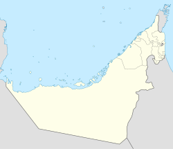 Liwa Oasis Location of Mezairaa, UAE. Considered the largest town in Liwa Oasis | |
| Coordinates: 23°07′56″N 53°47′48″E / 23.13231°N 53.79662°E | |
| Country | |
| Emirate | |
| Municipal region | Al Gharbia |
| Government | |
| • Type | Absolute monarchy |
| • Emir | Mohammed bin Zayed Al Nahyan |
| • Ruler's Representative of the Western Region of the Emirate of Abu Dhabi | Hamdan bin Zayed bin Sultan Al Nahyan |
| Population (2019) | |
| • Total | 20,192[1] |
| Time zone | UTC+4 (UAE Standard Time) |
Geography edit


Liwa Oasis is about 97.6 km (60.6 mi) south of the Persian Gulf coast and 150 km (93 mi) southwest of the city of Abu Dhabi, on the northern edge of Rub' al Khali desert. It is centered around 23°08′N 53°46′E / 23.133°N 53.767°E and stretches about 100 km (62 mi) east-west, along an arch curved to the north. It consists of some 50 villages. The geographic and economic center of the oasis is Muzayri`, where the highway from Abu Dhabi enters the oasis and then divides to the east (65 km (40 mi) to the easternmost village, Mahdar Bin `Usayyan) and west (45 km (28 mi) to the westernmost village, `Aradah). According to the census of population of 2005, the population was 20,196.[2] Earlier estimates judging from satellite images which gauged the population at 50,000 to 150,000, were too high.[3] The villages of Liwa Oasis are the southernmost settlements of Abu Dhabi and of the United Arab Emirates. The southern border of Abu Dhabi with Saudi Arabia, which runs at a distance between 16 and 35 km (9.9 and 21.7 mi) to the Oasis, is a straight line in the Rub al Khali desert, which is largely uninhabited. Mahdar Bin `Usayyan is the southernmost village of the Emirates, and also the easternmost of the oasis. 10 km (6.2 mi) south of the border, and 40 km (25 mi) south of the eastern part of the oasis is the Saudi oil facility Shaybah. However, there is no road linking Liwa Oasis and Shaybah, and no border crossing. A modern, multi-lane highway connects the oasis area to the capital, Abu Dhabi.
Villages edit

The USGS Geographic Names Database[4] lists 39 populated places in the area of the oasis, which are listed from west to east in the following table.
| Village | Arabic | Coordinates |
|---|---|---|
| `Aradah | عرادة | 22°59′00″N 53°26′00″E / 22.98333°N 53.43333°E |
| Milqatah | ملقطة | 23°04′00″N 53°32′00″E / 23.06667°N 53.53333°E |
| Al-`Idd | العيد | 23°04′48″N 53°33′02″E / 23.08000°N 53.55056°E |
| Al-Mariyah al-Gharbiyah | المارية الغربية | 23°06′12″N 53°34′48″E / 23.10333°N 53.58000°E |
| Humar | حمار | 23°05′04″N 53°35′03″E / 23.08444°N 53.58417°E |
| Khannur | خنور | 23°06′14″N 53°36′05″E / 23.10389°N 53.60139°E |
| Hamarur | حمرور | 23°06′00″N 53°36′31″E / 23.10000°N 53.60861°E |
| Taraq | طرق | 23°06′50″N 53°36′41″E / 23.11389°N 53.61139°E |
| Mujib | مجيب | 23°07′00″N 53°41′00″E / 23.11667°N 53.68333°E |
| Kayyah | جيه | 23°09′30″N 53°41′05″E / 23.15833°N 53.68472°E |
| Zuwayhir | ظويهر | 23°08′22″N 53°41′36″E / 23.13944°N 53.69333°E |
| Wafd | وفد | 23°06′20″N 53°42′50″E / 23.10556°N 53.71389°E |
| Umm al Qurayn | أم القرين | 23°06′00″N 53°43′00″E / 23.10000°N 53.71667°E |
| Qutuf | قطوف | 23°06′36″N 53°43′29″E / 23.11000°N 53.72472°E |
| Al-Atir | العاطر | 23°09′50″N 53°44′07″E / 23.16389°N 53.73528°E |
| Al-Mariyah | المارية | 23°08′30″N 53°44′30″E / 23.14167°N 53.74167°E |
| Dhafeer | ظفير | 23°07′50″N 53°45′37″E / 23.13056°N 53.76028°E |
| Jayf | جيف | 23°09′44″N 53°46′28″E / 23.16222°N 53.77444°E |
| Muzayri | مظيري | 23°08′19″N 53°47′14″E / 23.13861°N 53.78722°E |
| Nafir | نافر | 23°06′00″N 53°48′00″E / 23.10000°N 53.80000°E |
| Huwaylah | حويلة | 23°09′19″N 53°49′26″E / 23.15528°N 53.82389°E |
| Qurmidah | قرمدة | 23°07′08″N 53°49′42″E / 23.11889°N 53.82833°E |
| Hafif | هفيف \ حفيف | 23°08′52″N 53°50′29″E / 23.14778°N 53.84139°E |
| `Attab | عتاب | 23°09′14″N 53°52′46″E / 23.15389°N 53.87944°E |
| Shah | شاه | 23°08′33″N 53°54′51″E / 23.14250°N 53.91417°E |
| Huwaytayn | حويتين | 23°06′51″N 53°55′52″E / 23.11417°N 53.93111°E |
| Sabkhah | صبخة | 23°07′50″N 53°59′11″E / 23.13056°N 53.98639°E |
| Al-Hadhi | الهذي | 23°06′57″N 53°59′48″E / 23.11583°N 53.99667°E |
| Tharwaniyah | ثروانية | 23°05′00″N 54°01′00″E / 23.08333°N 54.01667°E |
| Al Mashrub | المشرب | 23°04′00″N 54°01′00″E / 23.06667°N 54.01667°E |
| An-Nashshash | النشاش | 23°05′00″N 54°02′00″E / 23.08333°N 54.03333°E |
| Dahin | داهن | 23°04′00″N 54°05′00″E / 23.06667°N 54.08333°E |
| Wadhil | واظل | 23°03′00″N 54°08′00″E / 23.05000°N 54.13333°E |
| Mawsil | موصل | 23°01′00″N 54°09′00″E / 23.01667°N 54.15000°E |
| Al-Khis | الخيس | 23°00′00″N 54°12′00″E / 23.00000°N 54.20000°E |
| Quwaysah | قويسة | 22°59′00″N 54°14′00″E / 22.98333°N 54.23333°E |
| Hamim | حميم | 22°58′00″N 54°18′00″E / 22.96667°N 54.30000°E |
| Jurayrah | جريرة | 22°57′00″N 54°19′00″E / 22.95000°N 54.31667°E |
| Mahdar Bin `Usayyan | مهدر بن عصيان | 22°56′00″N 54°19′00″E / 22.93333°N 54.31667°E |
Economy edit

An important traditional branch of the economy is date farming. There is a widespread use of drip irrigation and greenhouses. The importance of tourism is on the rise. There are several hotels in the area including the Liwa Hotel in Muzayri`, Tilal Liwa Hotel, the Liwa Rest House in the same village and run by the government of Abu Dhabi, and the resort Qasr Al Sarab.[5]
The nearby Moreeb dune (22°59′N 53°47′E / 22.983°N 53.783°E), 22 kilometres (14 miles) south of Muzayri`, is 300 metres (980 feet) high, and is one of the largest dunes in the world. It attracts people every year during the Liwa festival,[6] where a large number of international and local visitors come to see the off-road and camel racing events.
History edit
The oasis is the place of birth of the ruling families of Abu Dhabi and Dubai. In 1793, the ruling family Al Nahyan moved their residence from Liwa to the Abu Dhabi.[7]
Traditionally, men from Liwa (Bani Yas tribe) were pearl divers on the coast during the summer months. Pearl diving offered an additional source of income.
The British explorer Wilfred Thesiger first arrived in Liwa around mid December 1946 in his first crossing of the Rub' Al Khali (Empty Quarter) desert.[8][9] This was followed by a second visit by Thesiger in early March 1948 during his second crossing of the Rub' Al Khali (Empty Quarter) desert.[8][10]
In popular culture edit
Desert scenes of East of Liwa Oasis, in the Rub' Al Khali desert, was the set of in the 2015 film Star Wars: The Force Awakens and it was used to represent Jakku, a desert planet.[11]
Desert scenes in the 2020 film Sonic the Hedgehog were filmed in Liwa Oasis.[12]
Desert scenes of the desert landscape of Liwa was filmed to represent the planet Arrakis in the 2021 film Dune[13] and 2024 film Dune: Part Two. [14]
Gallery edit
-
 The desert in the outskirts of Liwa Oasis
 -
 Sand dunes overlooking Liwa Oasis
 -
 Desert around Liwa
 -
 Liwa desert
 -
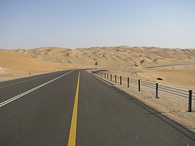 Road to Tal Moreeb
 -
 Qasr Al Sarab in Liwa
 -
 Mezairaa Fort
 -
 Arabian sand gazelle in Liwa


See also edit
References edit
- ^ The Report: Abu Dhabi 2010. Oxford Business Group. 21 March 2019. ISBN 9781907065217 – via Google Books.
- ^ a b "Al Gharbia". The Report Abu Dhabi 2010. Oxford Business Group. 2010. p. 171. ISBN 978-1-9070-6521-7.
- ^ "Liwa Oasis". Lexiorient. Retrieved 2012-07-05.
- ^ "Complete Files of Geographic Names for Geopolitical Areas from GNS (ISO/IEC 10646 [Unicode UTF-8]". Earth-info.nga.mil. Archived from the original on 2012-07-09. Retrieved 2012-07-05.
- ^ "Qasr Al Sarab Abu Dhabi". www.anantara.com. Retrieved May 9, 2023.
- ^ "Liwa International Festival / Moreeb Dune". Abu Dhabi: Abu Dhabi Tourism Office. Retrieved 2019-06-19.
- ^ Motohiro, Ono (March 2011). "Reconsideration of the Meanings of the Tribal Ties in the United Arab Emirates: Abu Dhabi Emirate in Early ʼ90s" (PDF). Kyoto Bulletin of Islamic Area Studies. 4–1 (2): 25–34. Retrieved 17 April 2013.
- ^ a b "Journey biographies | Thesiger's Journeys in Arabia - Second Empty Quarter Crossing 1947-8". web.prm.ox.ac.uk. Retrieved 2024-01-15.
- ^ "Agosto Foundation :: Wilfred Thesiger - Journeys". agosto-foundation.org. Retrieved 2024-01-15.
- ^ Thesiger, Wilfred (1959). Arabian Sands. Penguin Group. pp. 260–262. ISBN 978-1-101-16066-4.
- ^ "The harsh reality of building a 'Star Wars' fantasy in Abu Dhabi". LA Times. 3 December 2015.
- ^ "Watch: Key 'Sonic The Hedgehog' scenes were filmed in Abu Dhabi's Liwa desert". The National. 25 March 2020.
- ^ "Why Denis Villeneuve Shot 'Dune' During Abu Dhabi's Hottest Months: 'Strange Haze in the Air'". IndieWire. 27 September 2021.
- ^ "Where was 'Dune 2' filmed? All the stunning locations revealed". Timeout. 5 March 2024.
External links edit
![]() Media related to Liwa Oasis at Wikimedia Commons
Media related to Liwa Oasis at Wikimedia Commons