


Summary
Livry-Gargan (French pronunciation: [livʁi ɡaʁgɑ̃] ⓘ) is a commune in the northeastern suburbs of Paris, France. It is located 15.6 km (9.7 mi) from the center of Paris.
Livry-Gargan | |
|---|---|
 Livry-Gargan town hall | |
 Coat of arms | |
 Paris and inner ring departments | |
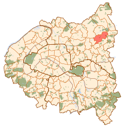
Location of Livry-Gargan .mw-parser-output .locmap .od{position:absolute}.mw-parser-output .locmap .id{position:absolute;line-height:0}.mw-parser-output .locmap .l0{font-size:0;position:absolute}.mw-parser-output .locmap .pv{line-height:110%;position:absolute;text-align:center}.mw-parser-output .locmap .pl{line-height:110%;position:absolute;top:-0.75em;text-align:right}.mw-parser-output .locmap .pr{line-height:110%;position:absolute;top:-0.75em;text-align:left}.mw-parser-output .locmap .pv>div{display:inline;padding:1px}.mw-parser-output .locmap .pl>div{display:inline;padding:1px;float:right}.mw-parser-output .locmap .pr>div{display:inline;padding:1px;float:left}html.skin-theme-clientpref-night .mw-parser-output .od,html.skin-theme-clientpref-night .mw-parser-output .od .pv>div,html.skin-theme-clientpref-night .mw-parser-output .od .pl>div,html.skin-theme-clientpref-night .mw-parser-output .od .pr>div{background:#000;color:#fff}html.skin-theme-clientpref-night .mw-parser-output .locmap{filter:grayscale(0.6)}@media(prefers-color-scheme:dark){html.skin-theme-clientpref-os .mw-parser-output .locmap{filter:grayscale(0.6)}html.skin-theme-clientpref-os .mw-parser-output .od,html.skin-theme-clientpref-os .mw-parser-output .od .pv>div,html.skin-theme-clientpref-os .mw-parser-output .od .pl>div,html.skin-theme-clientpref-os .mw-parser-output .od .pr>div{background:#000;color:#fff}}  Livry-Gargan  Livry-Gargan | |
| Coordinates: 48°55′09″N 2°32′10″E / 48.9192°N 2.5361°E | |
| Country | France |
| Region | Île-de-France |
| Department | Seine-Saint-Denis |
| Arrondissement | Le Raincy |
| Canton | Livry-Gargan |
| Intercommunality | Grand Paris |
| Government | |
| • Mayor (2020–2026) | Pierre-Yves Martin[1] |
| Area 1 | 7.38 km2 (2.85 sq mi) |
| Population (2021)[2] | 46,028 |
| • Density | 6,200/km2 (16,000/sq mi) |
| Time zone | UTC+01:00 (CET) |
| • Summer (DST) | UTC+02:00 (CEST) |
| INSEE/Postal code | 93046 /93190 |
| Elevation | 54–125 m (177–410 ft) |
| 1 French Land Register data, which excludes lakes, ponds, glaciers > 1 km2 (0.386 sq mi or 247 acres) and river estuaries. | |
History edit
On 20 May, 1869, a part of the territory of Livry-Gargan was detached and merged with a part of the territory of Clichy-sous-Bois and a small part of the territory of Gagny to create the commune of Le Raincy.
Population edit
|
| ||||||||||||||||||||||||||||||||||||||||||||||||||||||||||||||||||||||||||||||||||||||||||||||||||||||||||||||||||
| Source: EHESS[3] and INSEE (1968-2017)[4] | |||||||||||||||||||||||||||||||||||||||||||||||||||||||||||||||||||||||||||||||||||||||||||||||||||||||||||||||||||
Heraldry edit
 |
Over the centuries, the arms have changed depending on who owned the area. But the modern arms are :
|
Transport edit
Livry-Gargan is not served by any station of the Paris Métro, RER, or suburban rail network. The closest station to Livry-Gargan is Sevran – Livry station on Paris RER line B. This station is located in the neighboring commune of Sevran, 1.9 km (1.2 mi) from the town center of Livry-Gargan.tram 4 gargon Station is very near of village and in tram 4 direcation hopital de montfermeil there is two more station "Republique marx darmoy" and "Leon blum" this two station inside village livery gargon
Education edit
Schools include:[5]
- 9 preschools
- 9 elementary schools
- Junior high schools: LÉON-JOUHAUX, SEGPA du collège, ÉDOUARD-HERRIOT, LUCIE-AUBRAC
- Senior high schools: Lycée André Boulloche, Lycée Henri Sellier
Twin towns edit
Livry-Gargan is twinned with the communities of:
Personalities edit
- Grégory Arnolin, born in 1980, footballer
- Cassandre Beaugrand, born in 1997, Triathlete
- Karim Cheurfi, perpetrator of the 2017 shooting of Paris police officers
- Laetitia Avia, born in 1985, politician
- Aïssa Laïdouni, born in 1996, footballer
See also edit
References edit
- ^ "Répertoire national des élus: les maires". data.gouv.fr, Plateforme ouverte des données publiques françaises (in French). 2 December 2020.
- ^ "Populations légales 2021". The National Institute of Statistics and Economic Studies. 28 December 2023.
- ^ Des villages de Cassini aux communes d'aujourd'hui: Commune data sheet Livry-Gargan, EHESS (in French).
- ^ Population en historique depuis 1968, INSEE
- ^ "Enseignement." Livry-Gargan. Retrieved on September 7, 2016.
External links edit
- Official website (in French)