
KNOWPIA
WELCOME TO KNOWPIA

List of National Historic Landmarks in North Dakota 
Summary
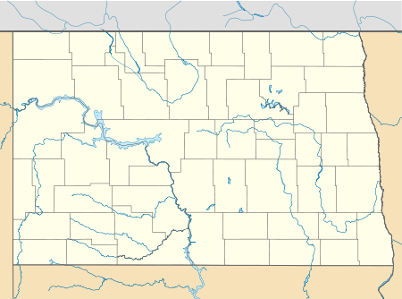
The List of National Historic Landmarks in North Dakota contains the landmarks designated by the U.S. Federal Government for the U.S. state of North Dakota. There are 7 National Historic Landmarks (NHLs) in North Dakota.
class=notpageimage|
North Dakota National Historic Landmarks (clickable map)Current National Historic Landmarks edit
| [1] | Landmark name | Image | Date designated[2] | Location | County | Description |
|---|---|---|---|---|---|---|
| 1 | Frederick A. and Sophia Bagg Bonanza Farm |  |
April 5, 2005 (#85002832) |
Mooreton 46°15′11″N 96°51′57″W / 46.253056°N 96.865833°W | Richland | Preserved bonanza farm. |
| 2 | Biesterfeldt Site | December 23, 2016 (#100000874) |
Lisbon vicinity 46°23′46″N 97°29′11″W / 46.396111°N 97.486389°W | Ransom | ||
| 3 | Big Hidatsa Village Site |  |
July 19, 1964 (#66000600) |
Stanton 47°21′41″N 101°23′22″W / 47.361255°N 101.389541°W | Mercer | Largest of three villages preserved in Knife River Indian Villages National Historic Site. |
| 4 | Fort Union Trading Post |  |
July 4, 1961 (#66000103) |
Williston vicinity 47°59′58″N 104°02′26″W / 47.999444°N 104.040556°W | McKenzie and Williams | Most important fur trading post on the upper Missouri until 1867. Visitors included John James Audubon, George Catlin, Father Pierre-Jean De Smet, Sitting Bull, Karl Bodmer, and Jim Bridger. |
| 5 | Huff Archeological Site | 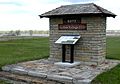 |
February 18, 1997 (#80002920) |
Huff 46°37′07″N 100°38′33″W / 46.618611°N 100.6425°W | Morton | Former fortified village of the Mandan, on the bank of Lake Oahe. Archaeological site, now a state park open to the public. |
| 6 | Lynch Knife River Flint Quarry |  |
July 13, 2011 (#11000629) |
near Dunn Center 47°21′12″N 102°37′22″W / 47.353333°N 102.622778°W | Dunn | |
| 7 | Menoken Indian Village Site |  |
July 19, 1964 (#66000599) |
Bismarck 46°50′29″N 100°31′06″W / 46.841495°N 100.518386°W | Burleigh | Site of 13th-century village, now a state park. |
See also edit
References edit
- ^ Numbers represent an alphabetical ordering by significant words. Various colorings, defined here, differentiate National Historic Landmarks and historic districts from other NRHP buildings, structures, sites or objects.
- ^ The eight-digit number below each date is the number assigned to each location in the National Register Information System database, which can be viewed by clicking the number.