


Summary
Licancabur (Spanish pronunciation: [likaŋkaˈβuɾ]) is a stratovolcano on the border between Bolivia and Chile, south of the Sairecabur volcano and west of Juriques. Part of the Andean Central Volcanic Zone, it has a prominent, 5,916-metre (19,409 ft)-high cone. A 400–500-metre (1,300–1,600 ft) summit crater containing Licancabur Lake, a crater lake which is among the highest lakes in the world, caps the volcano. There are no glaciers owing to the arid climate. Numerous animal species and plants live on the mountain.
| Licancabur | |
|---|---|
 | |
| Highest point | |
| Elevation | 5,916 m (19,409 ft) |
| Prominence | 1,426 m (4,678 ft) |
| Coordinates | 22°50′2″S 67°53′1″W / 22.83389°S 67.88361°W |
| Geography | |
 Licancabur Location of Licancabur | |
| Location | Chile / Bolivia |
| Parent range | Andes |
| Geology | |
| Age of rock | Holocene |
| Mountain type | Stratovolcano |
| Last eruption | Unknown |
| Climbing | |
| First ascent | Inca, pre-Columbian |
| Easiest route | Hike |
Licancabur formed atop of Pleistocene ignimbrites and has been active during the Holocene, after the ice ages. Three stages of lava flows emanate from the edifice and have a young appearance. Although no historic eruptions of the volcano are known, lava flows extending into Laguna Verde have been dated to 13,240 ± 100 BP and there may be residual heat in the mountain. The volcano has primarily erupted andesite, with small amounts of dacite and basaltic andesite.
Several archaeological sites occur on the mountain, both on its summit and at its northeastern foot. They were built presumably by the Inca or Atacama people for religious and cultural ceremonies, and are among the most important in the region. The mountain is the subject of a number of myths, which view it as the husband of another mountain, the hiding place of Inca or the burial of an Inca king.
Name and importance edit
The name Licancabur comes from the Kunza language,[1] where lican means "people" or "town" and cábur/[2] caur, caure or cauri "mountain";[3] it may refer to the archaeological sites at the mountain.[4] The name of the volcano has also been translated as "upper village".[5] Other names are Licancáguar,[2] Licancaur (which is another orthography),[4] Tata Likanku[6] and Volcán de Atacama.[7]
It is one of the best known volcanoes of Bolivia and Chile[8] and can be seen from San Pedro de Atacama.[9][10] The Inca conquered the region in the 14th century, with the Spaniards following in the 16th;[1] today mountaineering[11] and tourism are increasingly important.[12] Research on animal health,[13] remote sensing,[14] telecommunication[15] and Mars-like environments[a] has been conducted at Licancabur.[16]
Geography and geomorphology edit
The volcano is in the Puna de Atacama[19]/Cordillera Occidental of the Andes. Politically, it is located in the Antofagasta Region of Chile[20] and the Potosí Department of Bolivia;[18] the border goes over Licancabur[b].[8] Less than 20 kilometres (12 mi) south is the Llano del Chajnantor Observatory.[22] San Pedro de Atacama is 32 kilometres (20 mi) west[1] of Licancabur while the adjacent region in Bolivia is largely uninhabited.[12] The border crossing Paso de Jama and the Chile Route 27 between Argentina and Chile pass along the southern foot of Licancabur.[23][24] In 1953, a road led to 4,300 metres (14,000 ft) elevation.[2]
Licancabur is a 1.5 kilometres (0.93 mi) high and 9 kilometres (5.6 mi) wide[8] uneroded[20] symmetrical cone[8] with steep slopes.[25] The mountain dominates its surroundings.[26] The summit at 5,916 metres (19,409 ft) elevation[27][c] is capped by a 500 metres (1,600 ft)[20]-400 metres (1,300 ft) wide summit crater.[30] The 70 by 90 metres (230 ft × 300 ft)[25] freshwater Licancabur Lake[31] in the crater is one of the highest lakes in the world.[32] The western slopes are better developed than the eastern. The total volume of the volcano is about 35 cubic kilometres (8.4 cu mi)[8] or 44 cubic kilometres (11 cu mi),[33] formed by layers of lava and pyroclastics.[27] There are traces of lahars.[34]
Young-looking[8] black-grey[35] lava flows emanate from the summit crater[27] and surround the cone, reaching distances of 15 kilometres (9.3 mi) from the summit west of Licancabur.[25] The flows are 10–50 metres (33–164 ft)[20] thick block lavas,[32] and feature structures like ridges, levees[8] and blocks several metres thick. A debris avalanche deposit is found on the western side of Licancabur.[20] The slopes of the mountain are notably unstable.[36]

The landscape around the volcano consists of basins separated by mountain chains.[37] At the northeastern foot of Licancabur is Laguna Verde.[38] The mountain is part of the drainage divide between the Altiplano and the Salar de Atacama.[39] Southwest of Licancabur are the Vilama and San Pedro rivers, which flow to San Pedro de Atacama.[40]
Geology edit
Starting in the Jurassic, the Farallon Plate and later the Nazca Plate have been subducting under the South American Plate[41] in the Peru-Chile Trench. The subduction is still ongoing at a rate of 6.6 centimetres per year (2.6 in/year) and is responsible for the volcanism in the Andes,[42] as fluids emanating from the downgoing plate trigger melting within the overlying asthenosphere.[43] The Andean Central Volcanic Zone (CVZ) extends from southern Peru over Bolivia to Chile and Argentina,[41] it features the highest volcanoes in the world (Ojos del Salado)[44] and the Altiplano-Puna volcanic complex, one of the largest ignimbrite provinces on Earth.[45] Licancabur is part of the southern CVZ,[46] where there are over a thousand volcanoes.[47] Older (Miocene) volcanoes are widespread, while Pleistocene-Holocene systems are concentrated in the main volcanic chain.[48] Lascar erupts every few years.[49]
The volcanic chain continues north[26] across Portezuelo Chaxas mountain pass,[50] beginning with Sairecabur.[38] To the southeast is 5,704 metres (18,714 ft) high[7] Juriques, which formed during the Pleistocene and has a 1.5 kilometres (0.93 mi) wide summit crater;[25] the two volcanoes form an offset in the volcanic chain.[51] Farther south next to Portezuelo del Cajon[24] is Cerro Toco of the Purico complex.[19] The Chaxas lava dome was active during the Pliocene, forming ignimbrites that are now buried under Licancabur.[32]
The volcano is on the edge between the Altiplano and the Salar de Atacama basin.[8] The basement contains intrusions of Paleozoic and sedimentary rocks of Mesozoic age,[47] forming the "Antofalla domain" of the Arequipa-Antofalla tectonic block that originated separately from South America.[52] Between 4 kilometres (2.5 mi) and 30 kilometres (19 mi) depth is the Altiplano-Puna Magma Body, a giant magma chamber that extends under the southern Altiplano and to Licancabur.[51] At the volcano, the basement is covered by ignimbrites[32] from the Chaxas, La Pacana[8] and Purico volcanoes,[46] and lava domes of dacitic-rhyodacitic composition.[32] Ignimbrites crop out in gorges south of Licancabur.[53] Faults associated with the Calama-Olacapato-El Toro lineament cut through the basement in southeast direction[8] and probably influenced the growth of Licancabur and Juriques.[51] Some faults were active during the Holocene.[54]
Composition edit
Andesites are the main rocks at Licancabur, with some basaltic andesite and dacite.[55] They define an adakite-like suite,[56] and are less crystalline than rocks of other CVZ volcanoes.[46] The lavas were highly viscous, explaining why the Licancabur cone is so steep.[57] The main phenocryst phase is plagioclase, while amphibole, clinopyroxene, iron-titanium oxides, olivine and orthopyroxene are subordinate.[8] Crystals often form aggregates.[35] Xenoliths of gabbro are found within the rocks.[46] Unlike many neighbouring volcanoes, Licancabur lacks sulfur deposits.[1]
The magmas that built Licancabur formed through melting of altered oceanic crust[58] in the slab at 50–100 kilometres (31–62 mi) depth,[59] which in turn leads to melting in the mantle wedge that gives rise to the Licancabur magmas.[58] Assimilation of continental crustal rocks[58] and fractional crystallization of amphibole and garnet would explain trace element patterns.[59] The magmas were stored in a magma chamber, where crystals formed.[60]
Climate and vegetation edit
The climate is cold, dry, windy with low atmospheric pressure and large day-night temperature differences.[16] On the summit, daytime temperatures range between 5 – −25 °C (41 – −13 °F) and nighttime temperatures between −25 – −40 °C (−13 – −40 °F).[17] Annual mean precipitation at Licancabur is estimated to reach 360 millimetres (14 in), decreasing to 200 metres (660 ft) at its base,[61] but is highly variable in space and time.[62] The Atacama Desert is one of the driest on Earth.[63] The arid climate is due to subsidence of air within the South Pacific Anticyclone, which extends to the Andes.[64] Owing to the dry climate,[65] snow cover on Licancabur is ephemeral[1] and there are no glaciers.[65] During the local Last Glacial Maximum the snowline may have decreased to 4,000–4,800 metres (13,100–15,700 ft) elevation[66] but there is no evidence of glacial activity on Licancabur.[67] Periglacial phenomena occur on Licancabur.[68] The region likely has Earth's highest insolation rate.[d][71]
Plants growing on Licancabur include grasses, tola and yareta at high and cacti at low elevations.[72][73] There is a vertical structure, with cushion plants and tussocks dominating between 3,850–4,200 metres (12,630–13,780 ft) elevation, widely spaced shrubs between 2,700–3,100 metres (8,900–10,200 ft), and the highest plant density found between these belts.[29] Some areas are used as pastures.[74] Isolated wetlands occur at the foot of the volcano.[75]
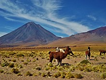
The fauna includes birds (black-hooded sierra finch, black-winged ground dove and Puna tinamou),[76] frogs (Rhinella spinulosa),[77] insects (butterflies,[73] cuckoo bees[e] and flies),[73] lizards (Liolaemus audituvelatus, Liolaemus barbarae, Liolaemus constanzae, Liolaemus fabiani and Liolaemus puritamensis),[79] mammals (Andean hairy armadillo,[80] chinchilla,[73] culpeo, guanaco, southern vizcacha and vicuña)[81] and toads (Telmatobius vilamensis).[77] The Bolivian sector is part of the Eduardo Avaroa Andean Fauna National Reserve.[82] In Chile, there were plans to create a protected area including Licancabur and El Tatio, but as of 2018[update] no progress had been made.[83]
Eruption history edit
The volcano formed mostly during the Late Pleistocene-Holocene,[42] and bears no traces of glacial erosion.[8] There are three generations of lava flows distinguishable through their appearance and chemistry: The basal unit, which crops out at the western and northeastern foot of the volcano and are the most primitive magmas; the intermediate unit, which forms most of its western and southern sectors; and the upper unit, which forms the central cone and represents the most differentiated magmas.[84] The older flows are found north and west of Licancabur, overlap with flows from Sairecabur[8] and are partly buried by debris avalanche deposits and moraines.[46] Activity at Licancabur impacted the environment at Laguna Verde, causing changes in water chemistry.[85]
An explosive eruption took place at some point, producing pyroclastic flows.[20] The flank lava flows are the most recent activity.[25] There are no known historical[8] or Holocene eruptions,[86] and the preservation of Inca ruins in the summit crater implies that it has been inactive for 600–1000 years.[27] However, the elevated temperatures of the summit crater lake imply there is still heat in the volcano,[87] and lava flows overran 13,240 ± 100 years old shorelines at Laguna Verde.[85]
Licancabur is considered to be potentially active owing to its good preservation.[67] SERNAGEOMIN deems it a low-hazard volcano, Chile's 68th most dangerous volcano out of 87 as of 2023[update].[88] Future eruptive processes will probably involve the emission of lava or pyroclastic flows from the summit and the flanks of Licancabur, especially the western one. The volcano is remote from inhabited areas and pyroclastic fallout would be of limited extent.[87] Impacts may extend to Argentina.[89]
Archaeology and religious importance edit
Prehistoric manmade constructions are widespread on the mountains of the region, including Licancabur and Juriques.[90] The complex on Licancabur includes multiple structures with mostly semicircular or rectangular shapes[91] and a ceremonial platform,[92] all in the eastern part of the crater.[91] The structures may have had had roofs[93] and are built like pircas (no mortar).[94] Reports in 1887[95] and 1955 mention piles of wood.[94] A semicircle of stones surrounding an upright stone has been compared to an altar, ushnu.[96] The summit sites were presumably used for equinox and solstice feasts.[97] Notably, no human sacrifices (capacocha) are associated with Licancabur.[92]

Another site, Tambo de Licancabur[98] or Tambo Licancabur,[99] lies at 4,600 metres (15,100 ft) elevation[100] on the northeastern foot of Licancabur.[101] It consists of over a hundred man-made structures[102] and a 70 metres (230 ft) long public square. More than a hundred people could stay at Tambo de Licancabur,[103] which was not permanently inhabited.[104] Both Inca and local pottery styles have been found there.[105] From Tambo de Licancabur, a zig-zag path led up to the mountain,[106][97] along which there are further Inca structures[107] from which Tambo de Licancabur was visible;[108] today the path is largely destroyed or blocked by landslides.[97] Tambo de Licancabur has been interpreted either as a site where, during festivities, people who could not ascent the mountain congregated[109] - a base camp, corpahuasi[110] - or as a tambo, an Inca waystation, on the road between San Pedro de Atacama and Inca territories in present-day Bolivia. This interpretation is not mutually exclusive with the former.[111][101] The whole Licancabur complex was one of the most important in the region,[107] and may have been part of a wider regional religious centre.[112] The archaeological sites on Licancabur are sometimes interpreted to be part of a lookout system for the region,[113][114] or as a symbol of Inca dominance in the San Pedro de Atacama area.[115] The Inca road passed at the foot of the volcano,[116] making the site easily accessible.[103]
The mountain was worshipped by the Atacameno[1] and Inca[101] until the 20th century.[2] Licancabur was important in local cultural rituals,[117] and is to this day used in culturally important events.[118] At least one burial in a local cemetery was oriented to Licancabur.[119]
There are several legends tied to the mountain: The male Licancabur was married to female Quimal in the Cordillera Domeyko,[90][120] and the two are considered paramount mountains which protect the local communities[121] and fertilize the ground during their copulation.[122] In the local Atacameno mythology the mountain controls fire (and San Pedro water),[123] while in Socaire's mythology it is a source of water.[124] In another myth Licancabur is the tomb of a legless Inca king[125] that was carried around the region in a litter.[126] A final tale says that once, the crater lake had fresh water. When Inca fled from white people to Licancabur, they hid their treasures. The waters of the lake turned bitter and its colour green.[127] Ascending the mountain was considered taboo,[2] and the mountain vigorously defends against violations of its summit;[97] allegedly the 1953 Calama earthquake was in retaliation for the ascent of the mountain in that year.[94] Whether there are legends of Inca treasury associated with Licancabur[97] is unclear.[2]
Ascent edit

The mountain was first ascended by the Inca or the Atacameno people.[94] The first documented ascent was by Severo Titichoca in November 1884,[128] and the first by Westerners in 22 November 1953 by a group of engineers in Chuquicamata,[2] which reached the summit from the northwest.[2]
Licancabur is frequently climbed from the Bolivian side. It can be ascended year round, although more caution is needed during winter. Ascents take six hours, descents about half that.[127] There is a wide panorama from the summit.[129] Bad weather can develop quickly,[30] and ascending Licancabur is difficult owing to the unstable slopes of the upper cone.[130]
Notes edit
- ^ The environment around Licancabur may be the closest equivalent to Mars that exists on Earth,[16] and present-day conditions at the lakes around Licancabur may resemble these that formerly existed at lakes on Mars.[17][18]
- ^ Licancabur is explicitly mentioned in the Treaty of Valparaiso that establishes the border.[21]
- ^ Other elevations have been reported,[28][26] including heights exceeding 6,000 metres (20,000 ft).[29]
- ^ Claims that the UV index at Licancabur can reach values exceeding 40 have drawn scrutiny, as such high UV indices may not be plausible within Earth's atmosphere[69] even accounting for UV radiation reflected by clouds.[70]
- ^ A species of cuckoo bee has been named after the volcano.[78]
References edit
- ^ a b c d e f Rudolph 1955, p. 153.
- ^ a b c d e f g h Rudolph 1955, p. 154.
- ^ Garrido & Ballester 2021, p. 39.
- ^ a b Vaisse 1895, p. 545.
- ^ Bobylyova & Сергеевна 2016, p. 126.
- ^ Villagrán et al. 1998, p. 26.
- ^ a b GVP 2024, Synonyms & Subfeatures.
- ^ a b c d e f g h i j k l m n Figueroa & Deruelle 1996, p. 563.
- ^ Oppenheimer 1993, p. 66.
- ^ Butelski 2020, p. 7.
- ^ Fernández 2014, p. 157.
- ^ a b Nielsen, Calcina & Quispe 2003, p. 371.
- ^ Grandjean et al. 1996, p. 607.
- ^ Chen et al. 2008, p. 11.
- ^ Montgomery et al. 2004, p. 2194.
- ^ a b c Morris, Berthold & Cabrol 2007, p. 155.
- ^ a b Cabrol et al. 2003, p. 1.
- ^ a b Cabrol, Grin & Hock 2007, p. 4.
- ^ a b Rudolph 1955, p. 160.
- ^ a b c d e f Figueroa & Déruelle 1997, p. 322.
- ^ González Miranda & Leiva Gómez 2016, p. 19.
- ^ Giovanelli et al. 2001, p. 791.
- ^ Borsdorf & Stadel 2013, p. 78.
- ^ a b Amigo, Bertin & Orozco 2012, Hoja 3 de 5.
- ^ a b c d e GVP 2024, General Information.
- ^ a b c Rudolph 1955, p. 151.
- ^ a b c d SERNAGEOMIN 2024.
- ^ Brackebusch 1893, p. 567.
- ^ a b Cavieres et al. 2002, p. 1303.
- ^ a b Morris, Berthold & Cabrol 2007, p. 156.
- ^ Rudolph 1955, p. 164.
- ^ a b c d e GVP 2024, Photo Gallery.
- ^ Amigo, Bertin & Orozco 2012, p. 37.
- ^ Amigo, Bertin & Orozco 2012, p. 39.
- ^ a b Figueroa & Déruelle 1997, p. 324.
- ^ Rudolph 1955, p. 161.
- ^ Quintanilla 1976, p. 28.
- ^ a b Figueroa & Deruelle 1996, p. 564.
- ^ Niemeyer 1980, p. 59.
- ^ Sepúlveda Rivera et al. 2015, pp. 189–190.
- ^ a b Amigo, Bertin & Orozco 2012, p. 5.
- ^ a b Amigo, Bertin & Orozco 2012, p. 6.
- ^ Godoy et al. 2017, p. 172.
- ^ Amigo, Bertin & Orozco 2012, p. 7.
- ^ Godoy et al. 2017, p. 173.
- ^ a b c d e Figueroa, Déruelle & Demaiffe 2009, p. 311.
- ^ a b Tibaldi, Bonali & Corazzato 2017, p. 18.
- ^ Tibaldi, Bonali & Corazzato 2017, p. 23.
- ^ Häder & Cabrol 2018, p. 157.
- ^ Le Paige 1978, p. 37.
- ^ a b c González-Maurel et al. 2019, p. 3.
- ^ Mamani, Worner & Sempere 2010, p. 170.
- ^ Guest 1968, p. 177.
- ^ Tibaldi, Bonali & Corazzato 2017, p. 28.
- ^ Figueroa & Deruelle 1996, p. 566.
- ^ Figueroa, Déruelle & Demaiffe 2009, p. 314.
- ^ Kussmaul et al. 1977, p. 88.
- ^ a b c Figueroa, Déruelle & Demaiffe 2009, p. 317.
- ^ a b Figueroa, Déruelle & Demaiffe 2009, p. 315.
- ^ Figueroa & Déruelle 1997, p. 326.
- ^ Sepúlveda Rivera et al. 2015, p. 189.
- ^ Quintanilla 1976, p. 30.
- ^ Giovanelli et al. 2001, p. 789.
- ^ Gjorup et al. 2019, p. 311.
- ^ a b Gjorup et al. 2019, p. 310.
- ^ Tibaldi, Bonali & Corazzato 2017, p. 19.
- ^ a b Francis & De Silva 1989, p. 250.
- ^ Gjorup et al. 2019, p. 312.
- ^ McKenzie et al. 2017, p. 1.
- ^ McKenzie et al. 2017, p. 2.
- ^ Rondanelli, Molina & Falvey 2015, p. 416.
- ^ Quintanilla 1976, p. 34.
- ^ a b c d Rudolph 1955, p. 170.
- ^ Díaz Sanz et al. 2022, p. 23.
- ^ Calamatta 1975, p. 29.
- ^ Möller 2003, p. 7.
- ^ a b Möller 2003, p. 4.
- ^ Packer & Graham 2020, p. 10.
- ^ Möller 2003, pp. 2–3.
- ^ Möller 2003, p. 5.
- ^ Möller 2003, pp. 5–6.
- ^ SERNAP 2020.
- ^ Porcaro, Vejsbjerg & Benedetti 2018, 6. 5. 3. Las anp de la región circumpuneña (rc).
- ^ Figueroa & Déruelle 1997, pp. 322, 325.
- ^ a b Häder & Cabrol 2018, p. 163.
- ^ GVP 2024, Eruptive History.
- ^ a b Amigo, Bertin & Orozco 2012, p. 16.
- ^ SERNAGEOMIN 2023.
- ^ González et al. 2008, p. 459.
- ^ a b Le Paige 1978, p. 38.
- ^ a b Reinhard 1985, p. 302.
- ^ a b Vitry 2020, p. 517.
- ^ Ceruti 2016, p. 73.
- ^ a b c d Rudolph 1955, p. 156.
- ^ Geographischer Monatsbericht 1887, p. 155.
- ^ Farrington 2022, p. 244.
- ^ a b c d e Le Paige 1966, p. 49.
- ^ Salazar, Berenguer & Vega 2013, p. 103.
- ^ Nielsen et al. 1999, p. 100.
- ^ Le Paige 1978, p. 41.
- ^ a b c Nielsen, Berenguer & Sanhueza 2006, p. 222.
- ^ Reinhard 1983, p. 56.
- ^ a b Reinhard & Ceruti 2010, p. 93.
- ^ Le Paige 1978, p. 39.
- ^ Reinhard & Ceruti 2006, p. 14.
- ^ Vitry 2020, p. 513.
- ^ a b Reinhard 1985, p. 305.
- ^ Reinhard & Ceruti 2010, p. 97.
- ^ Le Paige 1966, p. 50.
- ^ Ceruti 2016, p. 70.
- ^ Reinhard & Ceruti 2006, p. 15.
- ^ Ceruti 2012, p. 268.
- ^ Pizarro 2010, p. 25.
- ^ Rudolph 1955, p. 165.
- ^ Echenique et al. 2021, p. 18.
- ^ Aros & Ibaceta 1994, p. 31.
- ^ Barthel 1959, p. 33.
- ^ Sepúlveda, Ayala & Aguilar 2008, p. 7.
- ^ Torres et al. 1991, p. 642.
- ^ Barros 1997, pp. 87–88.
- ^ Moraga 2010, p. 393.
- ^ Contreras 1994, p. 183.
- ^ Chocobar & Tironi 2023, p. 80.
- ^ Sherbondy 1986, p. 66.
- ^ Nielsen, Berenguer & Sanhueza 2006, p. 232.
- ^ Nielsen 2009, p. 29.
- ^ a b SERNAP 2023.
- ^ Rudolph 1955, p. 159.
- ^ Rudolph 1955, p. 166.
- ^ Rudolph 1955, p. 152.
Sources edit
- Amigo, A.; Bertin, D.; Orozco, G. (2012). Peligros Volcánicos de la zona norte de Chile, Regiones de Arica y Parinacota, Tarapacá, Antofagasta y Atacama (PDF) (Report). Carta Geológica de Chile, Serie Geología Ambiental 17 (in Spanish). Servicio Nacional de Geología y Minería. Retrieved 18 March 2024.
- Aros, Francisco F; Ibaceta, Claudio Alberto Galeno (1994). "Alguien llamado Licancabur". Cuadernos de Arquitectura. Habitar el Norte. (in Spanish) (4): 30–35. doi:10.22199/S07198590.1994.0004.00006. ISSN 0719-8590.
- Barros, Alonso (1997). "Pachamama y desarrollo: paisajes conflictivos en el Desierto de Atacama". Estudios Atacameños (13): 75–94. doi:10.22199/S07181043.1997.0013.00006. ISSN 0716-0925. JSTOR 25674662.
- Barthel, Thomas S. (1959). "Ein Frühlingsfest der Atacameños". Zeitschrift für Ethnologie (in German). 84 (1): 25–45. ISSN 0044-2666. JSTOR 25840568.
- Bobylyova, E. S.; Сергеевна, Бобылева Елена (15 December 2016). "Structural-and-Semantic Analysis of Oronyms of Chile". RUDN Journal of Language Studies, Semiotics and Semantics (in Russian) (2): 123–127. ISSN 2411-1236.
- Borsdorf, Axel; Stadel, Christoph (2013), "Naturgeographische Faktoren, Prozesse und Räume", Die Anden (in German), Berlin, Heidelberg: Springer Berlin Heidelberg, pp. 38–89, doi:10.1007/978-3-8274-2458-7_2, ISBN 978-3-8274-2457-0, retrieved 2024-03-19
- Brackebusch, Luis (1 January 1893). "La cordillera chileno-arjentina". Anales de la Universidad de Chile (in Spanish): 565–578. ISSN 0717-8883.
- Butelski, Kazimierz (1 December 2020). "Public Buildings of North Chile's Desert Architecture". IOP Conference Series: Materials Science and Engineering. 960 (2): 022059. Bibcode:2020MS&E..960b2059B. doi:10.1088/1757-899x/960/2/022059.
- Cabrol, N. A.; Grin, E. A.; McKay, C. P.; Friedmann, I.; Diaz, G. Chong; Demergasso, C.; Kisse, K.; Grigorszky, I.; Ocampo Friedmann, R.; Hock, A.; Fike, D. A.; Tambley, C.; Escudero, L.; Murbach, M. S.; Devore, E.; Grigsby, B. H. (March 2003). The Licancabur Project: Exploring the Limits of Life in the Highest Lake on Earth as an Analog to Martian Paleolakes. 34th Annual Lunar and Planetary Science Conference. League City, Texas. Bibcode:2003LPI....34.1393C. 1393.
- Cabrol, Nathalie A.; Grin, Edmond A.; Hock, Andrew N. (13 September 2007). "Mitigation of environmental extremes as a possible indicator of extended habitat sustainability for lakes on early Mars". In Hoover, Richard B.; Levin, Gilbert V.; Rozanov, Alexei Y.; Davies, Paul C. W. (eds.). Instruments, Methods, and Missions for Astrobiology X. Vol. 6694. pp. 335–346. doi:10.1117/12.731506.
- Calamatta, George Serracino (1975). "Los movimientos de los cazadores y recolectores en la Cordillera de Los Andes, entre la latitud 21º y 26º y longitud 67º 00' y 70º 22'". Estudios Atacameños (En línea) (in Spanish) (3): 19–39. doi:10.22199/S07181043.1975.0003.00005. ISSN 0718-1043.
- Cavieres, Lohengrin A.; Arroyo, Mary T.K.; Posadas, Paula; Marticorena, Clodomiro; Matthei, Oscar; Rodríguez, Roberto; Squeo, Francisco A.; Arancio, Gina (2002). "Identification of priority areas for conservation in an arid zone: application of parsimony analysis of endemicity in the vascular flora of the Antofagasta region, northern Chile". Biodiversity and Conservation. 11 (7): 1301–1311. doi:10.1023/A:1016001714358.
- Ceruti, Constanza (2016). "Inca Mountaintop Shrines and Glaciers in the High Andes". Journal of Glacial Archaeology. 3: 59–78. doi:10.1558/jga.34465. ISSN 2050-3407 – via EBSCO.
- Ceruti, Maria Constanza (December 2012). "A la Sombra del Socompa: Ascensos a las Cimas de los volcanes Rosado, Mellado y Socompa Caipis". Cuadernos Universitarios. ISSN 2250-7124.
- Chen, Bin; Cabrol, Nathalie; McKay, Christopher P.; Shi, Chao; Gu, Claire; Newhouse, Rebecca; Zhang, Jin; Lam, Tuling; Pei, Qibing (28 August 2008). "Mix and match: enhanced Raman spectroscopy instrumentation in field applications". In Hoover, Richard B.; Levin, Gilbert V.; Rozanov, Alexei Y.; Davies, Paul C. (eds.). Instruments, Methods, and Missions for Astrobiology XI. Vol. 7097. pp. 320–334. doi:10.1117/12.802772.
- Chocobar, Sonia Ramos; Tironi, Manuel (20 July 2023). "Un Sol Interior: Vulcanología Lickanantay en el Salar de Atacama". Revista de Estudios Latinoamericanos sobre Reducción del Riesgo de Desastres REDER (in Spanish). 7 (2): 73–87. doi:10.55467/reder.v7i2.125. ISSN 0719-8477.
- Contreras, Ernesto (1994). "Cultura y naturaleza en la cuenca del Salar de Atacama". Estudios Atacameños (En línea) (in Spanish) (11): 179–185. doi:10.22199/S07181043.1994.0011.00011. ISSN 0718-1043.
- Díaz Sanz, Mª Cristina; Lozano Valencia, Pedro José; Roxana, Lebuy Castillo; Meaza Rodriguez, Guillermo (11 October 2022). "Aplicación de la metodología de valoración biogeográfica "LANBIOEVA" a las agrupaciones vegetales altoandinas de Atacama (Chile)". Boletín de la Asociación de Geógrafos Españoles (in European Spanish) (94). doi:10.21138/bage.3248.
- Echenique, Ester; Nielsen, Axel E.; Avila, Florencia; Hayashida, Frances; Uribe, Mauricio; Gilstrap, William (November 2021). "Interregional interactions across the Southern Andes: Yavi-Chicha ceramic circulation in northern Chile during the Late pre-Hispanic periods". Archaeological and Anthropological Sciences. 13 (11): 212. Bibcode:2021ArAnS..13..212E. doi:10.1007/s12520-021-01451-9.
- Farrington, Ian (2022-12-31), Hayashida, Frances M.; Troncoso, Andrés; Salazar, Diego (eds.), "Chapter 13 Perspectives on Understanding Qullasuyu", Rethinking the Inka, University of Texas Press, pp. 241–260, doi:10.7560/323854-017, ISBN 978-1-4773-2386-1, retrieved 2024-03-19
- Fernández, Damir Galaz-Mandakovic (2014). "Uyuni, capital turística de Bolivia. Aproximaciones antropológicas a un fenómeno visual posmoderno desbordante". Teoría y Praxis. 10 (16): 147–173. doi:10.22403/UQROOMX/TYP16/06. ISSN 1870-1582.
- Figueroa, Oscar A.; Deruelle, Bernard (September 1996). LICANCABUR, AN ANDESITIC VOLCANO OF THE SOUTH-CENTRAL ANDES (PDF) (Report).
- Figueroa, Oscar; Déruelle, Bernard (October 1997). El volcán Licancabur −22°56'S, 67°53'W, segunda región de Antofagasta-: Geología, petrografía y mineralogía (PDF). 8th Chilean Geological Congress (in Spanish). Antofagasta. Archived from the original (PDF) on November 18, 2016.
- Figueroa, Oscar; Déruelle, Bernard; Demaiffe, Daniel (28 February 2009). "Genesis of adakite-like lavas of Licancabur volcano (Chile—Bolivia, Central Andes)". Comptes Rendus. Géoscience. 341 (4): 310–318. Bibcode:2009CRGeo.341..310F. doi:10.1016/j.crte.2008.11.008.
- Francis, P.W.; De Silva, S.L. (April 1989). "Application of the Landsat Thematic Mapper to the identification of potentially active volcanoes in the central Andes". Remote Sensing of Environment. 28: 245–255. doi:10.1016/0034-4257(89)90117-X.
- Garrido, Francisco; Ballester, Benjamín (30 December 2021). "El viaje a Quillagua de Ricardo Latcham en 1932: notas y reflexiones desde un manuscrito inédito". Boletín Museo Nacional de Historia Natural (in Spanish). 70 (2): 21–42. doi:10.54830/bmnhn.v70.n2.2021.206. ISSN 0719-935X.
- "Geographischer Monatsbericht". Petermanns Geographische Mitteilungen (in German). 33. 1887.
- Giovanelli, Riccardo; Darling, Jeremy; Sarazin, Marc; Yu, Jennifer; Harvey, Paul; Henderson, Charles; Hoffman, William; Keller, Luke; Barry, Don; Cordes, James; Eikenberry, Stephen; Gull, George; Harrington, Joseph; Smith, J. D.; Stacey, Gordon; Swain, Mark (1 July 2001). "The Optical/Infrared Astronomical Quality of High Atacama Sites. I. Preliminary Results of Optical Seeing". Publications of the Astronomical Society of the Pacific. 113 (785): 789. arXiv:astro-ph/0103345. Bibcode:2001PASP..113..789G. doi:10.1086/322135. ISSN 1538-3873.
- Gjorup, Davi Feital; Francelino, Marcio Rocha; Michel, Roberto Ferreira Machado; Senra, Eduardo Osório; Schaefer, Carlos Ernesto G.R. (October 2019). "Pedoclimate monitoring in the periglacial high mountain soils of the Atacama Desert, northern Chile". Permafrost and Periglacial Processes. 30 (4): 310–329. Bibcode:2019PPPr...30..310G. doi:10.1002/ppp.2029.
- Godoy, Benigno; Wörner, Gerhard; Le Roux, Petrus; de Silva, Shanaka; Parada, Miguel Ángel; Kojima, Shoji; González-Maurel, Osvaldo; Morata, Diego; Polanco, Edmundo; Martínez, Paula (July 2017). "Sr- and Nd- isotope variations along the Pleistocene San Pedro – Linzor volcanic chain, N. Chile: Tracking the influence of the upper crustal Altiplano-Puna Magma Body". Journal of Volcanology and Geothermal Research. 341: 172–186. Bibcode:2017JVGR..341..172G. doi:10.1016/j.jvolgeores.2017.05.030.
- González, Maria A; Tello, Graciela; Fracchia, Diego; Solis, Natalia G. (January 2008). "Peligros geológicos en Jujuy". Relatorio del 17º Congreso Geológico Argentino (in Spanish). Asociación Geológica Argentina. pp. 443–464 – via ResearchGate.
- González-Maurel, Osvaldo; le Roux, Petrus; Godoy, Benigno; Troll, Valentin R.; Deegan, Frances M.; Menzies, Andrew (November 2019). "The great escape: Petrogenesis of low-silica volcanism of Pliocene to Quaternary age associated with the Altiplano-Puna Volcanic Complex of northern Chile (21°10′-22°50′S)". Lithos. 346–347: 105162. doi:10.1016/j.lithos.2019.105162.
- González Miranda, Sergio; Leiva Gómez, Sandra (June 2016). "EL NORTE GRANDE DURANTE EL CICLO DEL SALITRE: LA POLÍTICA SALITRERA Y LA POLÍTICA EXTERIOR EN LA FORMACIÓN DE UN ESPACIO TRANSFRONTERIZO (BOLIVIA Y CHILE, 1880-1929)". Estudios atacameños (52): 11–29. ISSN 0718-1043.
- Grandjean, D.; DRISS, F.; SERGHERAERT, R.; VALETTE, J.; MICHEL, A.; LUIGI, R. (1996). "CONSEQUENCES BIOLOGIQUES ET NUTRITIONNELLES DU TRAVAIL EN HAUTE ALTITUDE CHEZ LE CHIEN DE RECHERCHE: EXPEDITION SCIENTIFIQUE CHIENS DES CIMES-LICANCABUR 1996". Recueil de médecine vétérinaire (in French). 172 (11–12): 601–621 – via ResearchGate.
- Guest, John Edward (April 1968). "Banded Pumice in a Chilean Ignimbrite". Geological Magazine. 105 (2): 177–184. Bibcode:1968GeoM..105..177G. doi:10.1017/S0016756800052559.
- Häder, Donat-Peter; Cabrol, Nathalie A. (2018), "UV and Life Adaptation Potential on Early Mars: Lessons From Extreme Terrestrial Analogs", From Habitability to Life on Mars, Elsevier, pp. 233–248, Bibcode:2018fhlm.book..233H, doi:10.1016/b978-0-12-809935-3.00009-8, ISBN 978-0-12-809935-3, retrieved 2024-03-19
- "Licancabur". Global Volcanism Program. Smithsonian Institution. Retrieved 18 March 2024.
- Kussmaul, S.; Hörmann, P.K.; Ploskonka, E.; Subieta, T. (April 1977). "Volcanism and structure of southwestern Bolivia". Journal of Volcanology and Geothermal Research. 2 (1): 73–111. Bibcode:1977JVGR....2...73K. doi:10.1016/0377-0273(77)90016-6.
- Le Paige, Gustavo (1966). "El santuario incaico del Licancabur: (Prov. de Antofagasta, Chile)". Anales de Arqueología y Etnología (in Spanish). 21: 49–50. Retrieved 18 March 2014.
- Le Paige, Gustavo (1978). "Vestigios arqueológicos incaicos en las cumbres de la zona atacameña". Estudios Atacameños (6): 36–52. ISSN 0716-0925. JSTOR 25674576.
- Mamani, M.; Worner, G.; Sempere, T. (1 January 2010). "Geochemical variations in igneous rocks of the Central Andean orocline (13 S to 18 S): Tracing crustal thickening and magma generation through time and space". Geological Society of America Bulletin. 122 (1–2): 162–182. Bibcode:2010GSAB..122..162M. doi:10.1130/B26538.1 – via Academia.edu.
- McKenzie, Richard; Liley, Ben; Kotkamp, Michael; Disterhoft, Patrick (2017). "Peak UV: Spectral contributions from cloud enhancements". AIP Conference Proceedings. 1810 (1): 110008. Bibcode:2017AIPC.1810k0008M. doi:10.1063/1.4975570.
- Montgomery, K.; Mundt, C.; Thonier, G.; Tellier, A.; Udoh, U.; Barker, V.; Ricks, R.; Giovangrandi, L.; Davies, P.; Cagle, Y.; Swain, J.; Hines, J.; Kovacs, G. (2004). "Lifeguard - a personal physiological monitor for extreme environments". 3: 2192–2195. doi:10.1109/IEMBS.2004.1403640.
{{cite journal}}: Cite journal requires|journal=(help) - Moraga, Anita Carrasco (November 2010). "A Sacred Mountain and the Art of "Impression Management": Analyzing a Mining Company's Encounter With Indigenous Communities in Atacama, Chile". Mountain Research and Development. 30 (4): 391–397. doi:10.1659/MRD-JOURNAL-D-09-00065.1.
- Morris, R.; Berthold, R.; Cabrol, N. (2007). Diving at extreme altitude: dive planning and execution during the 2006 High Lakes Science Expedition. American Academy of Underwater Sciences 26th Symposium. Dauphin Island, Alabama: American Academy of Underwater Sciences. pp. 155–167 – via Academia.edu.
- Möller, Patricia (2003). Fauna silvestre: Alrededores del volcán Licancabur (Report) (in Spanish). Comisión Nacional del Medio Ambiente.
- Nielsen, Axel E.; Vázquez, María Magdalena; Avalos, Julio C.; Angiorama, Carlos Ignacio (1999). "Prospecciones arqueológicas en la reserva "Eduardo Avaroa" (Sud Lípez, Departamento Potosí, Bolivia)". Relaciones - Sociedad Argentina de Antropología (24): 95–124. ISSN 1852-1479.
- Nielsen, Axel; Calcina, Justino; Quispe, Bernardino (July 2003). "ARQUEOLOGÍA, TURISMO Y COMUNIDADES ORIGINARIAS: UNA EXPERIENCIA EN NOR LÍPEZ (POTOSÍ, BOLIVIA)". Chungará (Arica). 35 (2): 369–377. doi:10.4067/S0717-73562003000200018. ISSN 0717-7356.
- Nielsen, Axel E.; Berenguer, José; Sanhueza, Cecilia (December 2006). "El Qhapaqñan entre Atacama y Lípez". Intersecciones en antropología (7): 217–234. ISSN 1850-373X.
- Nielsen, Axel E. (2009). "Pastoralism and the Non-Pastoral World in the Late Pre-Columbian History of the Southern Andes (1000-1535)". Nomadic Peoples. 13 (2): 17–35. doi:10.3167/np.2009.130202. ISSN 0822-7942. JSTOR 43123848.
- Niemeyer, Hans (1980). 2a. Región de Antofagasta (Report). Hoyas hidrográficas de Chile (in Spanish). Dirección General de Aguas.
- Oppenheimer, Clive (March 1993). "Mines in the sky". Geology Today. 9 (2): 66–68. Bibcode:1993GeolT...9...66O. doi:10.1111/j.1365-2451.1993.tb00983.x.
- Packer, Laurence; Graham, Liam (December 2020). "Four new species of Isepeolini (Hymenoptera; Apidae) from northern Chile". BMC Zoology. 5 (1). doi:10.1186/s40850-020-00052-8.
- Pizarro, José Antonio González (2010). "Patrimonio, museos y arqueología: de la visibilidad de los pueblos indígenas a la institucionalización de los estudios arqueológicos en el Norte Grande de Chile". Diálogo Andino - Revista de Historia, Geografía y Cultura Andina (36): 15–32. ISSN 0716-2278.
- Porcaro, Tania; Vejsbjerg, Laila; Benedetti, Alejandro (2018), Núñez, Paula; Núñez, Andrés; Tamagnini, Marcela; Matossian, Brenda (eds.), "Capítulo 6. Áreas naturales protegidas, frontera y turismo en los Andes: comparaciones entre la región araucano-norpatagónica y la circumpuneña", Araucania-Norpatagonia II : La fluidez, lo disruptivo y el sentido de la frontera, Aperturas (in Spanish), Viedma, Río Negro, Argentina: Editorial UNRN, pp. 153–197, ISBN 978-987-3667-99-2, retrieved 2024-03-19
- Quintanilla, Vicente Guillermo (1 January 1976). "ZONACION ALTITUDINAL DE LA VEGETACION EN EL NORTE ARIDO CHILENO, A LA LATITUD DEL TROPICO DE CAPRICORNIO". Revista de Geografía Norte Grande (in Spanish) (5): 17–39. ISSN 0718-3402.
- Reinhard, Johan (1983). "High altitude archaeology and Andean mountain gods". American Alpine Journal. 25: 54–67 – via Google Books.
- Reinhard, Johan (1985). "Sacred Mountains: An Ethno-Archaeological Study of High Andean Ruins". Mountain Research and Development. 5 (4): 299–317. doi:10.2307/3673292. ISSN 0276-4741. JSTOR 3673292.
- Reinhard, J.; Ceruti, M. C. (2010). Inca rituals and sacred mountains: a study of the world's highest archaeological sites – via eScholarship.
- Reinhard, Johan; Ceruti, Maria Constanza (December 2006). "Sacred Mountains, Ceremonial Sites and Human Sacrifice among the Incas". Archeoastronomy: 1–43.
- Rondanelli, Roberto; Molina, Alejandra; Falvey, Mark (1 March 2015). "The Atacama Surface Solar Maximum". Bulletin of the American Meteorological Society. 96 (3): 405–418. Bibcode:2015BAMS...96..405R. doi:10.1175/BAMS-D-13-00175.1. ISSN 0003-0007.
- Rudolph, William E. (1955). "Licancabur: Mountain of the Atacameños". Geographical Review. 45 (2): 151–171. Bibcode:1955GeoRv..45..151R. doi:10.2307/212227. ISSN 0016-7428. JSTOR 212227.
- Salazar, Diego; Berenguer, José; Vega, Gabriela (March 2013). "PAISAJES MINERO-METALÚRGICOS INCAICOS EN ATACAMA Y EL ALTIPLANO SUR DE TARAPACÁ (NORTE DE CHILE)". Chungará (Arica). 45 (1): 83–103. doi:10.4067/S0717-73562013000100004. ISSN 0717-7356.
- Sepúlveda Rivera, Isabel; Molina Otárola, Raúl; Delgado-Serrano, María del Mar; Guerrero Ginel, José Emilio (December 2015). "Aguas, Riego y Cultivos: Cambios y Permanencias en los Ayllus de San Pedro de Atacama". Estudios atacameños (51): 185–206. doi:10.4067/S0718-10432015000200012. ISSN 0718-1043.
- Sepúlveda, T.; Ayala, P.; Aguilar, C. (2008). Retiro de cuerpos humanos de exhibición del Museo Arqueológico de San Pedro de Atacama (PDF) (Report) (in Spanish). Santiago: Servicio Nacional del Patrimonio Cultural. Archived from the original (PDF) on 19 July 2020.
- "VOLCANES ALREDEDOR DE SAN PEDRO DE ATACAMA" (in Spanish). SERNAGEOMIN. Retrieved 18 March 2024.
- "NUEVO RANKING DE RIESGO ESPECÍFICO DE VOLCANES ACTIVOS DE CHILE" (in Spanish). SERNAGEOMIN. 2023. Retrieved 18 March 2024.
- "La Reserva Nacional de Fauna Andina Eduardo Avaroa cumple 47 años de creación" (in Spanish). SERNAP. 13 December 2020. Archived from the original on 1 October 2023.
- "Atractivos turísticos". SERNAP (in Spanish). Bolivian government. Archived from the original on 1 October 2023. Retrieved 1 October 2023.
- Sherbondy, Jeanette E. (2 June 1986). "Los ceques: Código de canales en el Cusco Incaico". Allpanchis (in Spanish). 18 (27): 39–74. doi:10.36901/allpanchis.v18i27.1008. ISSN 2708-8960.
- Tibaldi, A.; Bonali, F.L.; Corazzato, C. (March 2017). "Structural control on volcanoes and magma paths from local- to orogen-scale: The central Andes case". Tectonophysics. 699: 16–41. Bibcode:2017Tectp.699...16T. doi:10.1016/j.tecto.2017.01.005.
- Torres, Constantino Manuel; Repke, David B.; Chan, Kelvin; McKenna, Dennis; Llagostera, Agustin; Schultes, Richard Evans (1991). "Snuff Powders from Pre-Hispanic San Pedro de Atacama: Chemical and Contextual Analysis". Current Anthropology. 32 (5): 640–649. doi:10.1086/204014. ISSN 0011-3204. JSTOR 2743701.
- Vaisse, Emilio F. (1 January 1895). "Glosario de la lengua atacameña". Anales de la Universidad de Chile (in Spanish): 527–556. ISSN 0717-8883.
- Villagrán, Carolina; Castro, Victoria; Sánchez, Gilberto; Romo, Marcela; Latorre, Claudio; Hinojosa, Luis Felipe (1998). "La tradición surandina del desierto: Etnobotánica del área del Salar de Atacama (Provincia de El Loa, Región de Antofagasta, Chile)". Estudios Atacameños (16): 7–105. ISSN 0716-0925. JSTOR 25674713.
- Vitry, Christian (September 2020). "Los Caminos Ceremoniales en los Apus del Tawantinsuyu". Chungará (Arica). 52 (3): 509–521. doi:10.4067/S0717-73562020005001802. ISSN 0717-7356.
Bibliography edit
- Biggar, Cathy; Biggar, John (2001). The Andes: A Trekking Guide. Andes. ISBN 978-0-9536087-1-3.
- Dillehay, Tom D.; Netherly, Patricia (1998). La Frontera del Estado Inca (in Spanish). Editorial Abya Yala. ISBN 978-9978-04-977-8.
- Mena, Mauricio (2018). El Licancabur tiene su historia, todos los cerros la tienen. Mitos, leyendas y fábulas altoandinas (in Spanish). San Pedro de Atacama: Ediciones del Desierto.
External links edit
- Cabrol, Nathalie A.; Feister, Uwe; Häder, Donat-Peter; Piazena, Helmut; Grin, Edmond A.; Klein, Andreas (2014). "Record solar UV irradiance in the tropical Andes". Frontiers in Environmental Science. 2 (19): 1. Bibcode:2014FrES....2...19C. doi:10.3389/fenvs.2014.00019. ISSN 2296-665X.
- Häder, Donat-P.; Feister, Uwe; Cabrol, Nathalie A. (2015). "Response: "Comment on Record solar UV irradiance in the tropical Andes, by Cabrol et al."". Frontiers in Environmental Science. 3. doi:10.3389/fenvs.2015.00068. ISSN 2296-665X.
- McKenzie, Richard L.; Bernhard, Germar; Madronich, Sasha; Zaratti, Francesco (2015). "Comment on "Record solar UV irradiance in the tropical Andes, by Cabrol et al."". Frontiers in Environmental Science. 3. doi:10.3389/fenvs.2015.00026. ISSN 2296-665X.
- Ramos Chocobar, Sonia; Tironi, Manuel (2022). "An Inside Sun: Lickanantay Volcanology in the Salar de Atacama". Frontiers in Earth Science. 10. Bibcode:2022FrEaS..10.9967R. doi:10.3389/feart.2022.909967. ISSN 2296-6463.
- Trivelli Jolly, Miguel Ángel; Huerta Pizarro, Jorge Antonio (2014). Alcances sobre flora y vegetación de la Cordillera de Los Andes : Región de Antofagasta. SAG (Chile) (Report) (in Spanish).
- Licancabur, tour 2003
- Lake Licancabur
- Licancabur, cerca de Marte – Mercuria Calama article – (In Spanish).