
KNOWPIA
WELCOME TO KNOWPIA

Le Teich 
Summary
Le Teich (French pronunciation: [lə tɛʃ]) is a commune in the Gironde department in Nouvelle-Aquitaine in southwestern France.
Le Teich | |
|---|---|
 The church in Le Teich | |
 Coat of arms | |
Location of Le Teich .mw-parser-output .locmap .od{position:absolute}.mw-parser-output .locmap .id{position:absolute;line-height:0}.mw-parser-output .locmap .l0{font-size:0;position:absolute}.mw-parser-output .locmap .pv{line-height:110%;position:absolute;text-align:center}.mw-parser-output .locmap .pl{line-height:110%;position:absolute;top:-0.75em;text-align:right}.mw-parser-output .locmap .pr{line-height:110%;position:absolute;top:-0.75em;text-align:left}.mw-parser-output .locmap .pv>div{display:inline;padding:1px}.mw-parser-output .locmap .pl>div{display:inline;padding:1px;float:right}.mw-parser-output .locmap .pr>div{display:inline;padding:1px;float:left}html.skin-theme-clientpref-night .mw-parser-output .od,html.skin-theme-clientpref-night .mw-parser-output .od .pv>div,html.skin-theme-clientpref-night .mw-parser-output .od .pl>div,html.skin-theme-clientpref-night .mw-parser-output .od .pr>div{background:#000;color:#fff}html.skin-theme-clientpref-night .mw-parser-output .locmap{filter:grayscale(0.6)}@media(prefers-color-scheme:dark){html.skin-theme-clientpref-os .mw-parser-output .locmap{filter:grayscale(0.6)}html.skin-theme-clientpref-os .mw-parser-output .od,html.skin-theme-clientpref-os .mw-parser-output .od .pv>div,html.skin-theme-clientpref-os .mw-parser-output .od .pl>div,html.skin-theme-clientpref-os .mw-parser-output .od .pr>div{background:#000;color:#fff}}  Le Teich  Le Teich | |
| Coordinates: 44°38′05″N 1°01′21″W / 44.6347°N 1.0225°W | |
| Country | France |
| Region | Nouvelle-Aquitaine |
| Department | Gironde |
| Arrondissement | Arcachon |
| Canton | Gujan-Mestras |
| Intercommunality | CA Bassin d'Arcachon Sud |
| Government | |
| • Mayor (2023–2026) | Karine Desmoulin[1] |
| Area 1 | 87.08 km2 (33.62 sq mi) |
| Population (2021)[2] | 9,004 |
| • Density | 100/km2 (270/sq mi) |
| Time zone | UTC+01:00 (CET) |
| • Summer (DST) | UTC+02:00 (CEST) |
| INSEE/Postal code | 33527 /33470 |
| Elevation | 0–35 m (0–115 ft) (avg. 7 m or 23 ft) |
| 1 French Land Register data, which excludes lakes, ponds, glaciers > 1 km2 (0.386 sq mi or 247 acres) and river estuaries. | |
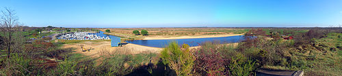
In this commune, there is a park created in order to observe birds without putting them in danger.
Population edit
| Year | Pop. | ±% p.a. |
|---|---|---|
| 1968 | 1,680 | — |
| 1975 | 2,176 | +3.76% |
| 1982 | 2,946 | +4.42% |
| 1990 | 3,607 | +2.56% |
| 1999 | 4,822 | +3.28% |
| 2007 | 6,284 | +3.37% |
| 2012 | 6,891 | +1.86% |
| 2017 | 7,906 | +2.79% |
| Source: INSEE[3] | ||
Twin towns – sister cities edit
See also edit
References edit
- ^ "Répertoire national des élus: les maires" (in French). data.gouv.fr, Plateforme ouverte des données publiques françaises. 6 June 2023.
- ^ "Populations légales 2021". The National Institute of Statistics and Economic Studies. 28 December 2023.
- ^ Population en historique depuis 1968, INSEE
Wikimedia Commons has media related to Le Teich.