


Summary
Kupang Regency is a regency in East Nusa Tenggara province of Indonesia. It occupies the far western end of Timor Island (apart from the area of Kupang city, which has been administratively separated from the Regency since 11 April 1996), together with the smaller island of Semau (off the southwestern tip of Timor) and other minor offshore islands (of which Kera is the only inhabited). Other islands further to the southwest and west which were formerly part of Kupang Regency have been separated administratively - the Rote Islands Group on 10 April 2002 (to form Rote Ndao Regency), and the Savu Islands on 29 October 2008 (to form Sabu Raijua Regency).
Kupang Regency
Kabupaten Kupang | |
|---|---|
 Seal | |
 Location within East Nusa Tenggara | |
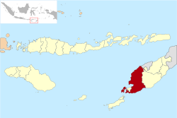
 Kupang Regency  Kupang Regency Kupang Regency (Lesser Sunda Islands)  Kupang Regency Kupang Regency (Indonesia) | |
| Coordinates: 10°18′S 123°43′E / 10.300°S 123.717°E | |
| Country | |
| Region | Lesser Sunda Islands |
| Province | |
| Capital | Oelamasi |
| Government | |
| • Regent | Korinus Masneno |
| • Vice Regent | Jerry Manafe |
| Area | |
| • Total | 2,045.62 sq mi (5,298.13 km2) |
| Population (mid 2023 estimate) | |
| • Total | 379,464 |
| • Density | 190/sq mi (72/km2) |
| [1] | |
| Time zone | UTC+8 (ICST) |
| Area code | (+62) 380 |
| Website |
|
The residual regency covers an area of 5,298.13 km2 (2,045.62 sq. miles); it had a population of 304,548 at the 2010 Census and 366,383 at the 2020 Census; the official estimate as at mid 2023 was 376,837 (comprising 190,886 males and 185,951 females).[1] The capital of Kupang Regency is at Oelamasi.[2]
Administration edit
The regency is divided into twenty-four districts (kecamatan), tabulated below with their areas and their populations at the 2010 Census[3] and the 2020 Census,[4] together with the official estimates as at mid 2023.[1] The table also includes the locations of the district administrative centres, the number of administrative villages in each district (totaling 160 rural desa and 17 urban kelurahan), and its post code.
| Kode Wilayah |
Name of District (kecamatan) |
English name | Area in km2 |
Pop'n Census 2010 |
Pop'n Census 2020 |
Pop'n Estimate mid 2023 |
Admin centre |
No. of desa |
No. of kelurahan |
Post code |
|---|---|---|---|---|---|---|---|---|---|---|
| 53.01.04 | Semau | Semau Island (North) | 143.42 | 6,688 | 7,614 | 7,697 | Uitao | 8 | - | 85352 |
| 53.01.23 | Semau Selatan | Semau Island (South) | 153.00 | 4,731 | 5,396 | 5,458 | Akle | 6 | - | 85353 |
| Totals Semau Island | Semau Island | 296.42 | 11,419 | 13,010 | 13,155 | 14 | - | |||
| 53.01.05 | Kupang Barat | West Kupang | 149.72 | 15,417 | 18,270 | 18,692 | Batakte | 10 | 2 | 85351 |
| 53.01.16 | Nekamese | 128.40 | 9,010 | 11,524 | 12,061 | Oemasi | 11 | - | 85390 | |
| 53.01.08 | Kupang Tengah | Central Kupang | 88.64 | 33,805 | 45,709 | 48,635 | Tarus | 7 | 1 | 85361 |
| 53.01.24 | Taebenu | 106.42 | 14,594 | 18,166 | 18,859 | Baumata | 8 | - | 85360 | |
| 53.01.09 | Amarasi | 154.90 | 15,279 | 17,881 | 18,226 | Oekabiti | 8 | 1 | 85367 | |
| 53.01.17 | Amarasi Barat | West Amarasi | 246.47 | 14,375 | 16,846 | 17,178 | Teunbaun | 7 | 1 | 85376 |
| 53.01.18 | Amarasi Selatan | South Amarasi | 172.71 | 10,276 | 11,839 | 12,011 | Buraen | 3 | 2 | 85377 |
| 53.01.19 | Amarasi Timur | East Amarasi | 162.92 | 7,054 | 8,935 | 9,324 | Pakubaun | 4 | - | 85378 |
| 53.01.06 | Kupang Timur | East Kupang | 338.60 | 40,525 | 51,032 | 53,164 | Babau | 8 | 5 | 85362 |
| 53.01.20 | Amabi Oefeto Timur | East Amabi Oefeto | 236.72 | 13,059 | 13,277 | 12,978 | Oemofa | 10 | - | 85363 |
| 53.01.25 | Amabi Oefeto | Amabi Oefeto | 123.90 | 7,747 | 8,611 | 8,643 | Fatuknutu | 7 | - | 85362 & 85363 |
| 53.01.07 | Sulamu | 141.18 | 14,280 | 17,394 | 17,941 | Sulamu | 6 | 1 | 85368 | |
| 53.01.10 | Fatuleu | 351.52 | 23,007 | 26,849 | 27,343 | Camplong | 9 | 1 | 85371 | |
| 53.01.27 | Fatuleu Barat | West Fatuleu | 496.47 | 8,399 | 9,070 | 9,026 | Poto | 5 | - | 85323 |
| 53.01.28 | Fatuleu Tengah | Central Fatuleu | 107.85 | 4,885 | 5,736 | 5,852 | Oelbiteno | 4 | - | 85320 |
| 53.01.11 | Takari | 508.13 | 20,262 | 24,566 | 25,304 | Takari | 9 | 1 | 85369 | |
| 53.01.12 | Amfoang Selatan | South Amfoang | 305.09 | 8,628 | 10,003 | 10,167 | Lelogama | 6 | 1 | 85373 |
| 53.01.21 | Amfoang Barat Daya | Southwest A167mfoang | 167.61 | 4,263 | 5,075 | 5,199 | Manubelon | 4 | - | 85364 |
| 53.01.13 | Amfoang Utara | North Amfoang | 428.59 | 7,004 | 8,091 | 8,215 | Soliu | 5 | 1 | 85365 |
| 53.01.22 | Amfoang Barat Laut | Northwest Amfoang | 133.24 | 8,762 | 10,376 | 10,613 | Nunuanah | 6 | - | 85372 |
| 53.01.26 | Amfoang Timur | East Amfoang | 174.21 | 7,101 | 7,713 | 7,689 | Fatumonas | 5 | - | 85375 |
| 53.01.30 | Amfoang Tengah | Central Amfoang | 278,42 | 5,397 | 6,410 | 6,562 | Naikliu | 4 | - | 85374 |
| Totals | 5,298.13 | 304,548 | 366,383 | 376,837 | Oelamasi | 160 | 17 |
References edit
- ^ a b c Badan Pusat Statistik, Jakarta, 28 February 2024, Kabupaten Kupang Dalam Angka 2024 (Katalog-BPS 1102001.5301)
- ^ Government of Indonesia (9 August 1958), Establishment of the Second-level Administrative Regions under the First-level Administrative Region of Bali, West Nusa Tenggara and East Nusa Tenggara (in Indonesian), Indonesia Ministry of Law and Justice, UU No. 69/1958
- ^ Biro Pusat Statistik, Jakarta, 2011.
- ^ Badan Pusat Statistik, Jakarta, 2021.
External links edit
- Official website