


Summary
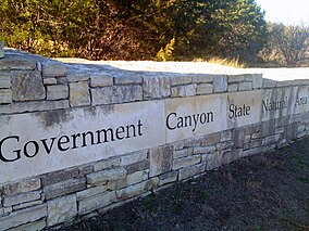
First opened to the public in October, 2005, Government Canyon State Natural Area (GCSNA) preserves 12,244 acres (49.5 km2; 19.1 sq mi) of rugged hills and canyons typical of the Texas Hill Country. It is designated a Natural Area, rather than a State Park, and therefore the primary focus is maintenance and protection of the property's natural state. Accordingly, access and recreational activities may be restricted if the Texas Parks & Wildlife Department (TPWD) deems such action necessary to protect the environment.
| Government Canyon State Natural Area | |
|---|---|
 | |
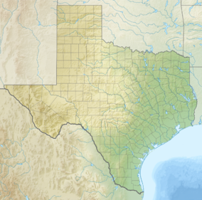  | |
| Location | Bexar County, Texas, United States |
| Nearest city | San Antonio |
| Coordinates | 29°32′53″N 98°45′54″W / 29.548°N 98.765°W |
| Area | 12,244 acres (49.55 km2) |
| Established | 1993 |
| Visitors | 82,904 (in 2022)[1] |
| Governing body | Texas Parks and Wildlife Department |
| Website | Government State Natural Area |
The reserve is located in northwestern Bexar County, and protects a large, relatively pristine tract of Hill Country terrain, numerous and diverse species of plants & wildlife, the upper Culebra Creek/Leon Creek watershed, and a critical aquifer recharge zone for the San Antonio Water System.[2]
In September, 2009, the City of San Antonio transferred 3,000 acres (12 km2) of land to the TPWD for inclusion in the Natural Area, specifically to support long-term protection of the Edwards Aquifer, and thereby increasing the total acreage within the reserve from 8,783 acres (35.54 km2) to 11,783 acres (47.68 km2). Most recently, in April, 2013, an additional 461 acres (1.87 km2) were added to GCSNA through a combination of funding from the City of San Antonio, Texas Parks & Wildlife, and a US Fish & Wildlife Service endangered species grant, which brought the reserve's total area to 12,244 acres (49.55 km2).
History edit

110 million years ago, during the Cretaceous period, much of Texas was covered by a shallow sea. As the sea receded, dinosaurs walking in the moist mud left behind tracks in the mud. Sediment filled the tracks and the mud turned to limestone. The sediment washed away and trackways are visible when conditions are dry. There are three main trackways made by theropods and sauropods, which researchers believe to be Acrocanthosaurus and Sauroposeidon.[3]
Archaeologists believe Native Americans occupied the area up to 8,000 years ago as evidenced by a burnt midden uncovered in the park. In the early 1850s, government surveyors laid out a military supply route through this area to western frontier forts. The locals called it the “government road” that was being built through the “government’s canyon” giving the park its name. European settlers came to the area around the 1860s. The clear springs, fertile floodplains and lush grasslands supported their farming and ranching activities. An old house and barn still exist as a reminder of the park's heritage.[4]
Fauna edit
As in much of the Hill Country, white-tailed deer are by far the most common large mammal on the property. Additionally, wild turkeys, nine-banded armadillos, skunks, raccoons, opossums, cottontail rabbits, jackrabbits, and fox squirrels are present.[2] Feral pigs, exotic axis deer, porcupines, rock squirrels, and ringtail may occasionally be encountered. Bobcats, coyotes, both red and grey foxes, and rarely, mountain lions, also inhabit the area, but are seldom seen by visitors. Reptiles documented include Texas alligator lizard, Texas coral snake and western diamondback rattlesnake.
Among the many bird species present, GCSNA includes nesting habitats of the golden-cheeked warbler and the black-capped vireo, both of which are classified as endangered. Common birds sighted include mourning dove, black vulture, turkey vulture, eastern phoebe, white-eyed vireo, Carolina wren, northern mockingbird, lesser goldfinch and northern cardinal.[5]
The major topography of GCSNA is karst. GCSNA is host to six endangered karst invertebrates: Government Canyon Bat Cave meshweaver, Government Canyon Bat Cave spider, Madla Cave meshweaver, two species of ground beetles (Rhadine exilis and Rhadine infernalis) and the Helotes mold beetle.[2]
Flora edit
A variety of trees are found in the park such as ashe juniper, plateau live oak, sycamore, honey mesquite, Texas persimmon, mountain laurel, Texas madrone, redbud, hackberry, cedar elm, and mulberry. Vines like mustang grape and poison ivy grow among the trees.
Some common plants are prickly pear cactus, twisted-leaf yucca, sotol, agarita, Turk's cap, scarlet sage, wafer ash, frostweed, Texas bluebonnet and goldeneye phlox. Open areas support many grasses such as inland sea oats and Lindheimer muhly
Visitors edit
GCSNA is open to the public 4 days (Fri. – Mon.) each week, weather permitting, and offers 40 miles (64 km) of hiking/biking trails,[6] with over 500 feet (150 m) of elevation change found within the reserve's boundaries. Entrance fee: $6 per adult; children 12 and under, free. Beginning Friday, October 5, 2012 the Natural Area will allow overnight camping on Fridays and Saturdays in the "Front Country" section only. There are regular walk-in 50–60 yards (46–55 m) campsites, and two group walk-in campsites that allow up to 16 persons per site.
TPWD urges all visitors to respect the LEAVE NO TRACE set of wilderness ethics when visiting the Natural Area: 1) Plan Ahead and Prepare, 2) Travel on Marked Trails Only, 3) Always Dispose of Waste Properly, 4) Leave Behind What You Find, 5) Never Build An Open Fire, 6) Respect All Wildlife, and 7) Be Considerate of Other Visitors.
References edit
- ^ Christopher Adams. "What is the most visited state park in Texas? Here's the top 10 countdown". KXAN.com. Retrieved November 21, 2023.
- ^ a b c "Government Canyon State Natural Area: Nature". Texas Parks and Wildlife Department. Retrieved October 16, 2023.
- ^ “Dinosaurs in the Canyon” interpretive sign. Texas Parks and Wildlife Department, Government Canyon State Natural Area. viewed 14 October 2023.
- ^ "Government Canyon State Natural Area: History: Nature". Texas Parks and Wildlife Department. Retrieved October 16, 2023.
- ^ "Birds of Government Canyon State Natural Area and Vicinity" (PDF). Texas Parks and Wildlife. Retrieved October 16, 2023.
- ^ "Texas Trails Network: Government Canyon State Natural Area (ID: 832)". Archived from the original on July 28, 2011. Retrieved January 25, 2010.
Other sources edit
- Texas Parks & Wildlife: City of San Antonio Transfers Almost 3,000 Acres to Government Canyon
- My San Antonio: City gives 3,000 acres of Government Canyon to state
- Leon Springs Business Association: City land to go to Government Canyon
- My San Antonio: City earns praise for land transfer
- My San Antonio: 461 more acres for Government Canyon
External links edit
- TPWD – Government Canyon State Natural Area
- Friends of Government Canyon
- [1] Add'l TPWD info