
KNOWPIA
WELCOME TO KNOWPIA

Bayankhongor 
Summary
Bayankhongor (Mongolian: Баянхонгор, lit. 'rich soft, or rich sweetheart') is the capital of the Bayankhongor Province (aimag) in Mongolia. The administration of the Bayankhongor Sum (district) is also located in the same place. The city is at an elevation of 1859 m above sea level, and has a population of 26,252 (2006).
Bayankhongor
Баянхонгор ᠪᠠᠶᠠᠨᠬᠣᠩᠭᠣᠷ | |
|---|---|
| Bayankhongor District | |
| Official Cyrillic transcription(s) | |
| • Mongolian Cyrillic | Баянхонгор |
| Classical Mongolian transcription(s) | |
| • Mongolian script | ᠪᠠᠶᠠᠨᠬᠣᠩᠭᠣᠷ |
 | |
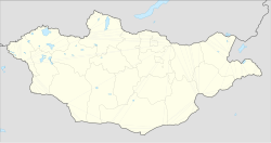 Bayankhongor Location in Mongolia | |
| Coordinates: 46°11′30″N 100°43′04″E / 46.19167°N 100.71778°E | |
| Country | |
| Province | Bayankhongor |
| Area | |
| • Total | 64.0 km2 (24.7 sq mi) |
| Elevation | 1,874 m (6,148 ft) |
| Population (2017) | |
| • Total | 30,931 |
| • Density | 480/km2 (1,300/sq mi) |
| Time zone | UTC+8 |
| Area code | +976 (0)144 |
| Climate | BSk |
| License plate | БХ_ (_ variable) |
Climate edit
Bayankhongor experiences a cold semi-arid climate (Köppen BSk) with long, dry, very cold winters and short, warm summers.
| Climate data for Bayankhongor (1991-2020, extremes 1963–present) | |||||||||||||
|---|---|---|---|---|---|---|---|---|---|---|---|---|---|
| Month | Jan | Feb | Mar | Apr | May | Jun | Jul | Aug | Sep | Oct | Nov | Dec | Year |
| Record high °C (°F) | 4.3 (39.7) |
9.1 (48.4) |
22.9 (73.2) |
27.3 (81.1) |
30.5 (86.9) |
33.0 (91.4) |
34.5 (94.1) |
34.0 (93.2) |
29.0 (84.2) |
20.3 (68.5) |
13.7 (56.7) |
7.0 (44.6) |
34.5 (94.1) |
| Mean daily maximum °C (°F) | −11.1 (12.0) |
−6.4 (20.5) |
1.3 (34.3) |
10.6 (51.1) |
17.3 (63.1) |
22.9 (73.2) |
24.7 (76.5) |
23.0 (73.4) |
16.8 (62.2) |
7.9 (46.2) |
−2.0 (28.4) |
−9.3 (15.3) |
8.0 (46.3) |
| Daily mean °C (°F) | −18.2 (−0.8) |
−14.3 (6.3) |
−6.2 (20.8) |
3.4 (38.1) |
10.1 (50.2) |
16.0 (60.8) |
18.2 (64.8) |
16.2 (61.2) |
9.6 (49.3) |
0.8 (33.4) |
−9.0 (15.8) |
−15.9 (3.4) |
0.9 (33.6) |
| Mean daily minimum °C (°F) | −23.3 (−9.9) |
−20.2 (−4.4) |
−12.6 (9.3) |
−3.5 (25.7) |
2.9 (37.2) |
9.3 (48.7) |
12.3 (54.1) |
10.1 (50.2) |
3.3 (37.9) |
−5.2 (22.6) |
−14.3 (6.3) |
−20.7 (−5.3) |
−5.2 (22.7) |
| Record low °C (°F) | −36.8 (−34.2) |
−35.9 (−32.6) |
−31.5 (−24.7) |
−23.3 (−9.9) |
−12.8 (9.0) |
−1.2 (29.8) |
1.1 (34.0) |
−1.1 (30.0) |
−9.6 (14.7) |
−25.5 (−13.9) |
−34.5 (−30.1) |
−39.9 (−39.8) |
−39.9 (−39.8) |
| Average precipitation mm (inches) | 2 (0.1) |
3 (0.1) |
5 (0.2) |
8 (0.3) |
16 (0.6) |
33 (1.3) |
55 (2.2) |
45 (1.8) |
17 (0.7) |
6 (0.2) |
3 (0.1) |
3 (0.1) |
196 (7.7) |
| Average precipitation days (≥ 1.0 mm) | 1.4 | 1.9 | 1.6 | 2.0 | 3.0 | 5.2 | 8.5 | 6.1 | 2.9 | 2.0 | 1.9 | 1.6 | 38.0 |
| Average relative humidity (%) | 62.6 | 57.6 | 49.5 | 41.8 | 40.7 | 47.1 | 53.4 | 52.6 | 48.5 | 50.6 | 56.2 | 60.8 | 51.8 |
| Mean monthly sunshine hours | 260.5 | 223.7 | 271.5 | 275.1 | 320.1 | 309.6 | 308.8 | 293.2 | 280.8 | 261.7 | 220.6 | 205.4 | 3,231 |
| Source 1: Pogoda.ru.net[1] | |||||||||||||
| Source 2: NOAA (sun 1962-1990) [2][3] | |||||||||||||
Administration edit
| # | bag name | Mongolian | Population (end of 2006) |
Area (km2) | Density (/km2) |
|---|---|---|---|---|---|
| 1 | Nomgon | Номгон | 3,426 | 10 | 343 |
| 2 | Erdenemandal | Эрдэнэмандал | 2,309 | 12 | 192 |
| 3 | Duursakh | Дуурсах | 2,753 | 10 | 275 |
| 4 | Ugalz | Угалз | 4,066 | 11 | 370 |
| 5 | Tsagaan chuluut | Цагаан чулуут | 3,441 | 10 | 344 |
| 6 | Gegeen shavi | Гэгээн шавь | 2,757 | 11 | 251 |
| 7 | Tsakhir | Цахир | 6,392 | 7 | 913 |
| Bayankhongor city proper | 25,144 | 71* | 354 | ||
| 8 | Shargaljuut** | Шаргалжуут | 1,444 | ... | ... |
* city area data in referenced sources are inconsistent.
** Shargaljuut is an urban-type settlement under Bayankhongor sum jurisdiction. Shargaljuut is located 54 km NE from Bayankhongor city.
Transportation edit
The Bayankhongor Airport (BVN/ZMBH) has two runways, one of them paved.
References edit
Wikivoyage has a travel guide for Bayanhongor.
- ^ КЛИМАТ БАЯНХОНГОРА (in Russian). Pogoda.ru.net. Retrieved 4 January 2015.
- ^ "Bayankhongor Climate Normals 1962-1990". National Oceanic and Atmospheric Administration. Retrieved January 14, 2013.
- ^ "World Meteorological Organization Climate Normals for 1991–2020". World Meteorological Organization. Retrieved 2 August 2023.
- ^ "Bayankhongor Aimag Statistical Office 2006 annual report: bag population" (PDF).[dead link]