


Summary
The 1936 United States presidential election in Montana took place on November 3, 1936 as part of the 1936 United States presidential election. Voters chose four representatives, or electors to the Electoral College, who voted for president and vice president.
| ||||||||||||||||||||||||||
| ||||||||||||||||||||||||||
 County Results
Roosevelt 50-60% 60-70% 70-80% 80-90%
| ||||||||||||||||||||||||||
| ||||||||||||||||||||||||||
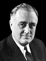

Montana voted overwhelmingly for the Democratic nominee, President Franklin D. Roosevelt, over the Republican nominee, Kansas Governor Alf Landon. Roosevelt won Montana by a landslide margin of 41.69% and remains the only presidential candidate ever to sweep every county in the state.[1] As of the 2020 presidential election[update], this was the last election in which Beaverhead County, Sweet Grass County, Stillwater County, Powder River County, and Fallon County voted for a Democratic presidential candidate.[2]
Results edit
| 1936 United States presidential election in Montana[3] | |||||
|---|---|---|---|---|---|
| Party | Candidate | Votes | Percentage | Electoral votes | |
| Democratic | Franklin D. Roosevelt (incumbent) | 159,690 | 69.28% | 4 | |
| Republican | Alf Landon | 53,598 | 27.59% | 0 | |
| Union | William Lemke | 5,549 | 2.41% | 0 | |
| Socialist | Norman Thomas | 1,066 | 0.46% | 0 | |
| Communist | Earl Browder | 385 | 0.17% | 0 | |
| Prohibition | D. Leigh Colvin | 224 | 0.10% | 0 | |
| Totals | 220,512 | 100.00% | 4 | ||
Results by county edit
| County | Franklin Delano Roosevelt Democratic |
Alfred Mossman Landon Republican |
William Frederick Lemke[4] Union |
Various candidates Other parties |
Margin | Total votes cast[a][5] | |||||
|---|---|---|---|---|---|---|---|---|---|---|---|
| # | % | # | % | # | % | # | % | # | % | ||
| Beaverhead | 2,153 | 60.85% | 1,304 | 36.86% | 75 | 2.12% | 6 | 0.17% | 849 | 24.00% | 3,538 |
| Big Horn | 2,037 | 63.94% | 1,087 | 34.12% | 55 | 1.73% | 7 | 0.22% | 950 | 29.82% | 3,186 |
| Blaine | 2,166 | 70.46% | 851 | 27.68% | 47 | 1.53% | 10 | 0.33% | 1,315 | 42.78% | 3,074 |
| Broadwater | 1,071 | 67.06% | 502 | 31.43% | 19 | 1.19% | 5 | 0.31% | 569 | 35.63% | 1,597 |
| Carbon | 3,116 | 63.90% | 1,617 | 33.16% | 97 | 1.99% | 46 | 0.94% | 1,499 | 30.74% | 4,876 |
| Carter | 929 | 65.70% | 464 | 32.81% | 18 | 1.27% | 3 | 0.21% | 465 | 32.89% | 1,414 |
| Cascade | 13,325 | 74.91% | 4,077 | 22.92% | 256 | 1.44% | 131 | 0.74% | 9,248 | 51.99% | 17,789 |
| Chouteau | 2,734 | 74.76% | 878 | 24.01% | 21 | 0.57% | 24 | 0.66% | 1,856 | 50.75% | 3,657 |
| Custer | 3,196 | 67.81% | 1,381 | 29.30% | 108 | 2.29% | 28 | 0.59% | 1,815 | 38.51% | 4,713 |
| Daniels | 1,596 | 75.46% | 467 | 22.08% | 27 | 1.28% | 25 | 1.18% | 1,129 | 53.38% | 2,115 |
| Dawson | 2,169 | 63.61% | 1,221 | 35.81% | 9 | 0.26% | 11 | 0.32% | 948 | 27.80% | 3,410 |
| Deer Lodge | 4,813 | 73.49% | 1,640 | 25.04% | 76 | 1.16% | 20 | 0.31% | 3,173 | 48.45% | 6,549 |
| Fallon | 1,015 | 61.11% | 598 | 36.00% | 39 | 2.35% | 9 | 0.54% | 417 | 25.11% | 1,661 |
| Fergus | 4,675 | 69.31% | 1,821 | 27.00% | 212 | 3.14% | 37 | 0.55% | 2,854 | 42.31% | 6,745 |
| Flathead | 5,408 | 63.38% | 2,460 | 28.83% | 539 | 6.32% | 125 | 1.47% | 2,948 | 34.55% | 8,532 |
| Gallatin | 4,697 | 65.53% | 2,151 | 30.01% | 286 | 3.99% | 34 | 0.47% | 2,546 | 35.52% | 7,168 |
| Garfield | 991 | 62.84% | 548 | 34.75% | 31 | 1.97% | 7 | 0.44% | 443 | 28.09% | 1,577 |
| Glacier | 2,453 | 75.13% | 781 | 23.92% | 21 | 0.64% | 10 | 0.31% | 1,672 | 51.21% | 3,265 |
| Golden Valley | 474 | 57.73% | 331 | 40.32% | 12 | 1.46% | 4 | 0.49% | 143 | 17.42% | 821 |
| Granite | 1,227 | 71.17% | 475 | 27.55% | 13 | 0.75% | 9 | 0.52% | 752 | 43.62% | 1,724 |
| Hill | 4,328 | 78.41% | 1,014 | 18.37% | 144 | 2.61% | 34 | 0.62% | 3,314 | 60.04% | 5,520 |
| Jefferson | 1,409 | 68.30% | 573 | 27.78% | 61 | 2.96% | 20 | 0.97% | 836 | 40.52% | 2,063 |
| Judith Basin | 1,534 | 68.76% | 645 | 28.91% | 31 | 1.39% | 21 | 0.94% | 889 | 39.85% | 2,231 |
| Lake | 2,656 | 60.06% | 1,401 | 31.68% | 341 | 7.71% | 24 | 0.54% | 1,255 | 28.38% | 4,422 |
| Lewis and Clark | 5,614 | 64.34% | 2,951 | 33.82% | 108 | 1.24% | 52 | 0.60% | 2,663 | 30.52% | 8,725 |
| Liberty | 758 | 71.17% | 276 | 25.92% | 25 | 2.35% | 6 | 0.56% | 482 | 45.26% | 1,065 |
| Lincoln | 2,117 | 69.41% | 745 | 24.43% | 150 | 4.92% | 38 | 1.25% | 1,372 | 44.98% | 3,050 |
| Madison | 1,819 | 62.94% | 1,006 | 34.81% | 52 | 1.80% | 13 | 0.45% | 813 | 28.13% | 2,890 |
| McCone | 1,366 | 78.55% | 332 | 19.09% | 7 | 0.40% | 34 | 1.96% | 1,034 | 59.46% | 1,739 |
| Meagher | 767 | 59.92% | 495 | 38.67% | 9 | 0.70% | 9 | 0.70% | 272 | 21.25% | 1,280 |
| Mineral | 657 | 68.44% | 215 | 22.40% | 73 | 7.60% | 15 | 1.56% | 442 | 46.04% | 960 |
| Missoula | 7,690 | 71.18% | 2,697 | 24.97% | 325 | 3.01% | 91 | 0.84% | 4,993 | 46.22% | 10,803 |
| Musselshell | 2,092 | 69.41% | 771 | 25.58% | 105 | 3.48% | 46 | 1.53% | 1,321 | 43.83% | 3,014 |
| Park | 2,968 | 70.40% | 1,006 | 23.86% | 212 | 5.03% | 30 | 0.71% | 1,962 | 46.54% | 4,216 |
| Petroleum | 523 | 64.89% | 258 | 32.01% | 25 | 3.10% | 0 | 0.00% | 265 | 32.88% | 806 |
| Phillips | 2,555 | 73.13% | 850 | 24.33% | 70 | 2.00% | 19 | 0.54% | 1,705 | 48.80% | 3,494 |
| Pondera | 2,213 | 75.43% | 658 | 22.43% | 45 | 1.53% | 18 | 0.61% | 1,555 | 53.00% | 2,934 |
| Powder River | 758 | 56.19% | 545 | 40.40% | 33 | 2.45% | 13 | 0.96% | 213 | 15.79% | 1,349 |
| Powell | 2,060 | 70.69% | 799 | 27.42% | 33 | 1.13% | 22 | 0.75% | 1,261 | 43.27% | 2,914 |
| Prairie | 877 | 64.34% | 454 | 33.31% | 23 | 1.69% | 9 | 0.66% | 423 | 31.03% | 1,363 |
| Ravalli | 2,859 | 60.42% | 1,580 | 33.39% | 253 | 5.35% | 40 | 0.85% | 1,279 | 27.03% | 4,732 |
| Richland | 2,516 | 68.43% | 1,066 | 28.99% | 83 | 2.26% | 12 | 0.33% | 1,450 | 39.43% | 3,677 |
| Roosevelt | 2,923 | 71.14% | 1,052 | 25.60% | 115 | 2.80% | 19 | 0.46% | 1,871 | 45.53% | 4,109 |
| Rosebud | 1,624 | 60.82% | 866 | 32.43% | 142 | 5.32% | 38 | 1.42% | 758 | 28.39% | 2,670 |
| Sanders | 1,788 | 65.37% | 718 | 26.25% | 181 | 6.62% | 48 | 1.76% | 1,070 | 39.12% | 2,735 |
| Sheridan | 2,503 | 79.01% | 513 | 16.19% | 91 | 2.87% | 61 | 1.93% | 1,990 | 62.82% | 3,168 |
| Silver Bow | 17,697 | 78.23% | 4,528 | 20.02% | 201 | 0.89% | 197 | 0.87% | 13,169 | 58.21% | 22,623 |
| Stillwater | 1,292 | 53.34% | 1,034 | 42.69% | 78 | 3.22% | 18 | 0.74% | 258 | 10.65% | 2,422 |
| Sweet Grass | 783 | 50.71% | 664 | 43.01% | 85 | 5.51% | 12 | 0.78% | 119 | 7.71% | 1,544 |
| Teton | 1,917 | 75.18% | 604 | 23.69% | 23 | 0.90% | 6 | 0.24% | 1,313 | 51.49% | 2,550 |
| Toole | 2,120 | 73.51% | 654 | 22.68% | 101 | 3.50% | 9 | 0.31% | 1,466 | 50.83% | 2,884 |
| Treasure | 398 | 59.49% | 244 | 36.47% | 25 | 3.74% | 2 | 0.30% | 154 | 23.02% | 669 |
| Valley | 5,862 | 83.07% | 996 | 14.11% | 144 | 2.04% | 55 | 0.78% | 4,866 | 68.95% | 7,057 |
| Wheatland | 1,037 | 62.51% | 602 | 36.29% | 18 | 1.08% | 2 | 0.12% | 435 | 26.22% | 1,659 |
| Wibaux | 790 | 68.04% | 362 | 31.18% | 6 | 0.52% | 3 | 0.26% | 428 | 36.86% | 1,161 |
| Yellowstone | 8,575 | 61.18% | 5,193 | 37.05% | 160 | 1.14% | 88 | 0.63% | 3,382 | 24.13% | 14,016 |
| Totals | 159,690 | 69.45% | 63,021 | 27.41% | 5,539 | 2.41% | 1,675 | 0.73% | 96,669 | 42.04% | 229,925 |
See also edit
Notes edit
- ^ There are some internal differences between these sources used to compile this table, so the figures given may not be perfectly exact.
References edit
- ^ Thomas, G. Scott; The Pursuit of the White House: A Handbook of Presidential Election Statistics and History, p. 437 ISBN 0313257957
- ^ Sullivan, Robert David; ‘How the Red and Blue Map Evolved Over the Past Century’; America Magazine in The National Catholic Review; June 29, 2016
- ^ Dave Leip’s U.S. Election Atlas; 1936 Presidential General Election Results – Montana
- ^ Géoelections; 1936 Presidential Election Popular Vote (.xlsx file for €15 on request)
- ^ Scammon, Richard M. (compiler); America at the Polls: A Handbook of Presidential Election Statistics 1920-1964; p. 271 ISBN 0405077114